Approximate Location Map
Large Map »
Latitude: 50.843 / 50°50'34"N
Longitude: -0.914 / 0°54'50"W
OS Eastings: 476557
OS Northings: 105390
OS Grid: SU765053
Mapcode National: GBR CF8.3QB
Mapcode Global: FRA 86ZW.1R6
Plus Code: 9C2XR3VP+59
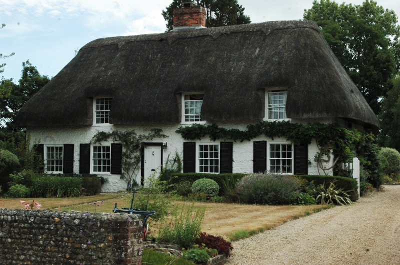
Entry Name: Prinsted Farmhouse
Listing Date: 28 January 1986
Grade: II
Source: Historic England
Source ID: 1354606
English Heritage Legacy ID: 301272
ID on this website: 101354606
Location: Prinsted, Chichester, West Sussex, PO10
County: West Sussex
District: Chichester
Civil Parish: Southbourne
Built-Up Area: Emsworth
Traditional County: Sussex
Lieutenancy Area (Ceremonial County): West Sussex
Church of England Parish: Southbourne St John the Evangelist
Church of England Diocese: Chichester
Tagged with: Farmhouse Thatched farmhouse
SOUTHBOURNE PRINSTED LANE, PRINSTED
SU 7605/7705 (north west arm)
27/508 Prinsted Farmhouse
-
- II
C17 or earlier building refaced with flints with brick dressings and quoins,
all now painted. Hipped thatched roof with three 'eyebrows'. Sash windows
with glazing bars intact. Two storeys. Three windows.
Listing NGR: SU7655705390
External links are from the relevant listing authority and, where applicable, Wikidata. Wikidata IDs may be related buildings as well as this specific building. If you want to add or update a link, you will need to do so by editing the Wikidata entry.


Other nearby listed buildings
