Latitude: 50.8368 / 50°50'12"N
Longitude: -0.7829 / 0°46'58"W
OS Eastings: 485802
OS Northings: 104844
OS Grid: SU858048
Mapcode National: GBR DGS.DWT
Mapcode Global: FRA 967W.JTY
Plus Code: 9C2XR6P8+PV
Entry Name: 49, West Street
Listing Date: 5 July 1950
Grade: II
Source: Historic England
Source ID: 1026579
English Heritage Legacy ID: 300295
ID on this website: 101026579
Location: Chichester, West Sussex, PO19
County: West Sussex
District: Chichester
Civil Parish: Chichester
Built-Up Area: Chichester
Traditional County: Sussex
Lieutenancy Area (Ceremonial County): West Sussex
Church of England Parish: Chichester St Paul
Church of England Diocese: Chichester
Tagged with: Building
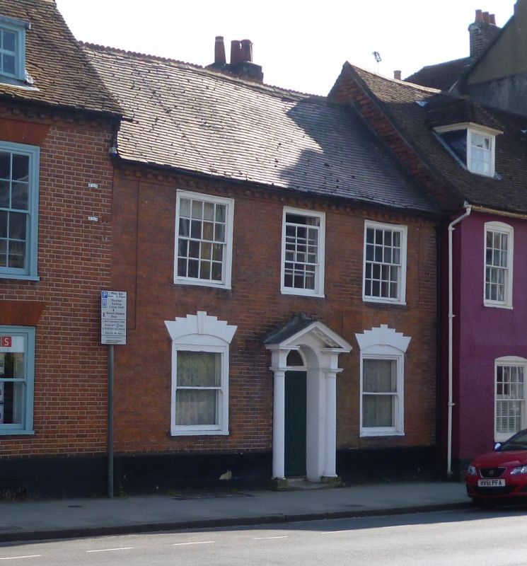
WEST STREET
1.
972
(South Side)
No 49
SU 8504 NE 3/145 5.7.50.
II
2.
Late C18 (later than No 48). In slight recession to the south in comparison
with No 48; lower frontage and lower roofline than No 48. Red tiled roof
with crest tiles; stacks behind. Brick dentilled cornice below eaves. Red
brick. 2 storeys, 3 windows. Sash windows with flush boxes with flat arches;
upper windows have glazing bars intact. Relieving arches with splayed backs
over ground floor windows, now painted; glazing bars missing from the same
windows. Door in reveals with 4 moulded panels and semi-circular fanlight
over; semi-circular doorway. Doorcase with engaged Doric columns, triglyphs
and rectangular pediment with modillions over.
Listing NGR: SU8580104842
External links are from the relevant listing authority and, where applicable, Wikidata. Wikidata IDs may be related buildings as well as this specific building. If you want to add or update a link, you will need to do so by editing the Wikidata entry.


Other nearby listed buildings