Approximate Location Map
Large Map »
Latitude: 51.0225 / 51°1'20"N
Longitude: -0.4522 / 0°27'7"W
OS Eastings: 508654
OS Northings: 125926
OS Grid: TQ086259
Mapcode National: GBR GHK.SLB
Mapcode Global: FRA 96YD.TYB
Plus Code: 9C3X2GCX+X4
Entry Name: The King's Arms Inn
Listing Date: 28 November 1980
Grade: II
Source: Historic England
Source ID: 1027096
English Heritage Legacy ID: 299106
ID on this website: 101027096
Location: Billingshurst, Horsham, West Sussex, RH14
County: West Sussex
District: Horsham
Civil Parish: Billingshurst
Built-Up Area: Billingshurst
Traditional County: Sussex
Lieutenancy Area (Ceremonial County): West Sussex
Church of England Parish: Billingshurst St Mary
Church of England Diocese: Chichester
Tagged with: Inn
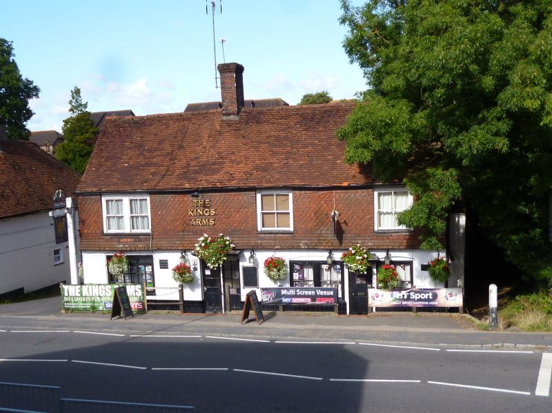
BILLINGSHURST HIGH STREET
1.
5404 (west side)
No 80
(The King's Arms Inn)
TQ 0825 25/393
II
2.
Probably C17 building, refaced with stucco on ground floor and tile-hanging
above. Tiled roof. Cl9 sash windows. Two doorways with flat hoods.
Listing NGR: TQ0864125925
External links are from the relevant listing authority and, where applicable, Wikidata. Wikidata IDs may be related buildings as well as this specific building. If you want to add or update a link, you will need to do so by editing the Wikidata entry.


Other nearby listed buildings
