Approximate Location Map
Large Map »
Latitude: 50.8103 / 50°48'37"N
Longitude: -0.5093 / 0°30'33"W
OS Eastings: 505122
OS Northings: 102258
OS Grid: TQ051022
Mapcode National: GBR GL5.41R
Mapcode Global: FRA 96TY.PD3
Plus Code: 9C2XRF6R+47
Entry Name: The Coach House
Listing Date: 20 September 1984
Grade: II
Source: Historic England
Source ID: 1027560
English Heritage Legacy ID: 298061
ID on this website: 101027560
Location: Rustington, Arun, West Sussex, BN16
County: West Sussex
District: Arun
Civil Parish: Rustington
Built-Up Area: Littlehampton
Traditional County: Sussex
Lieutenancy Area (Ceremonial County): West Sussex
Church of England Parish: Rushington
Church of England Diocese: Chichester
Tagged with: House
TQ 0502 RUSTINGTON THE STREET
26/163 (south side)
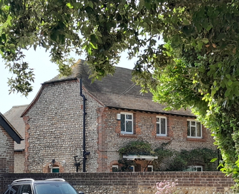
No 81 (The Coach House)
II
Originally the stables of the mansion to the east, now Nos 83, 85 and 87. Early C19.
Two storeys. Three windows. Faced with cobbles with red brick dressings and quoins.
Half-hipped tiled roof. Casement windows.
Listing NGR: TQ0512202258
External links are from the relevant listing authority and, where applicable, Wikidata. Wikidata IDs may be related buildings as well as this specific building. If you want to add or update a link, you will need to do so by editing the Wikidata entry.


Other nearby listed buildings
