Latitude: 51.2378 / 51°14'16"N
Longitude: -0.1979 / 0°11'52"W
OS Eastings: 525902
OS Northings: 150282
OS Grid: TQ259502
Mapcode National: GBR JJ0.BSW
Mapcode Global: VHGS9.J47X
Plus Code: 9C3X6RQ2+4V
Entry Name: Delville
Listing Date: 31 March 1977
Grade: II
Source: Historic England
Source ID: 1029139
English Heritage Legacy ID: 289283
ID on this website: 101029139
Location: Reigate, Reigate and Banstead, Surrey, RH2
County: Surrey
District: Reigate and Banstead
Electoral Ward/Division: Reigate Central
Parish: Non Civil Parish
Built-Up Area: Reigate
Traditional County: Surrey
Lieutenancy Area (Ceremonial County): Surrey
Church of England Parish: Reigate
Church of England Diocese: Southwark
Tagged with: Building
CHART LANE 1. 5388 (East Side) No I (Delville) TQ 2550 SE 13/33
II
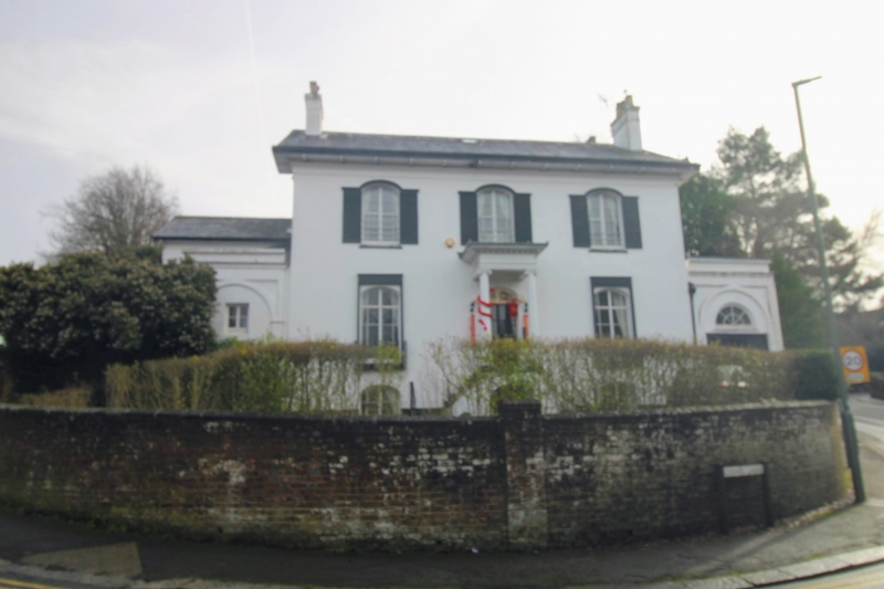
2. Early-mid C19 villa of 2 storeys and high basement, 3 windows. Stuccoed. Fairly low pitched slated roof with 2 pairs of end chimneys and a deep, bracketed eaves soffit above a moulded cornice. Segment-headed casement windows with margin lights and Venetian shutters. Similar glazing to door in prostyle Ionic porch with modillion cornice up 2 flights of angled steps with handrail. (Oddly, the respond pilasters have been omitted). Small single-storey side wings with round-arched openings.
Listing NGR: TQ2590850289
External links are from the relevant listing authority and, where applicable, Wikidata. Wikidata IDs may be related buildings as well as this specific building. If you want to add or update a link, you will need to do so by editing the Wikidata entry.


Other nearby listed buildings