Latitude: 51.2095 / 51°12'34"N
Longitude: 0.602 / 0°36'7"E
OS Eastings: 581842
OS Northings: 148810
OS Grid: TQ818488
Mapcode National: GBR QTF.30K
Mapcode Global: VHJMN.DV2M
Plus Code: 9F326J52+RQ
Entry Name: Stallance
Listing Date: 26 April 1968
Grade: II
Source: Historic England
Source ID: 1029823
English Heritage Legacy ID: 174177
ID on this website: 101029823
Location: The Harbour, Maidstone, Kent, ME17
County: Kent
District: Maidstone
Civil Parish: Sutton Valence
Traditional County: Kent
Lieutenancy Area (Ceremonial County): Kent
Tagged with: Building
SUTTON VALENCE RECTORY LANE TQ 84 NW 5/156 Stallance 26.4.68 GV II
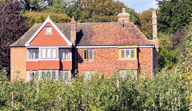
Farmhouse. Cl7, with gable end only of an earlier house, and late C18 and early C19 alterations. Timber framed, clad with red brick in Flemish bond with occasional grey bricks. Plain tile roof. Rear of main range has mathematical tiles to first floor. Lobby entry plan of 3 timber-framed bays including stack-bay, with 2-bay cross-wing projecting forwards to right. 2 storeys and attics on stone plinth. Dentilled eaves cornice. Roof half-hipped to left. Wing roof hipped. Multiple brick ridge stack to centre and slender projecting stack to right side of wing. 2 dormers, one with triangular pediment, one hipped. Irregular fenestration of 3 windows; one 12-pane mullioned sash to first floor of 2-storey later C19 or C20 rectangular brick bay to left of stack, one 2-light leaded casement beneath stack and one recessed 8-pane sash to gable end of wing. Door of 4 fielded panels, 2 top lights and flat dentilled bracketted hood under stack, against junction with wing. Rainwater head dated CW . 1767 Interior: Exposed framing left gable end incorporates jowled posts and arch-braced tie-beam of an earlier building, narrower than C17 house. Roof of staggered butt purlins with collars and re-used crown-post roof rafters. Newel staircase to attic.
Listing NGR: TQ8184248810
External links are from the relevant listing authority and, where applicable, Wikidata. Wikidata IDs may be related buildings as well as this specific building. If you want to add or update a link, you will need to do so by editing the Wikidata entry.


Other nearby listed buildings