Approximate Location Map
Large Map »
Latitude: 51.0844 / 51°5'3"N
Longitude: 0.6916 / 0°41'29"E
OS Eastings: 588613
OS Northings: 135122
OS Grid: TQ886351
Mapcode National: GBR QVX.TZM
Mapcode Global: FRA D6B8.385
Plus Code: 9F323MMR+QJ
Entry Name: 1-17, GRANGE ROAD (See details for further address information)
Listing Date: 8 June 1972
Grade: II
Source: Historic England
Source ID: 1031371
English Heritage Legacy ID: 179710
ID on this website: 101031371
Location: St Michaels, Ashford, Kent, TN30
County: Kent
District: Ashford
Civil Parish: Tenterden
Built-Up Area: Tenterden
Traditional County: Kent
Lieutenancy Area (Ceremonial County): Kent
Tagged with: Building
1.
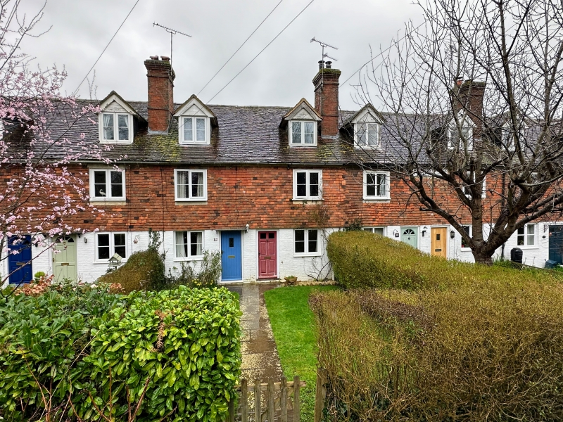
1715 GRANGE ROAD
ST MICHAELS
(North Side)
Nos 1 to 17 (consec)
St Michaels Terrace
TQ 83 NE 4/181
II GV
2.
Dated 1870 but built in a Georgian idiom. 2 storeys. The ground floor
is brick, the 1st floors are tile-hung. Hipped tiled roof with 9 brick
stacks and 15 hipped dormers on the front elevation. Casement windows.
Simple doorcases with double flat hoods.
Nos 1 to 17 (consec) St Michaels Terrace form a group.
Listing NGR: TQ8861335122
External links are from the relevant listing authority and, where applicable, Wikidata. Wikidata IDs may be related buildings as well as this specific building. If you want to add or update a link, you will need to do so by editing the Wikidata entry.


Other nearby listed buildings
