Latitude: 51.9937 / 51°59'37"N
Longitude: -0.3608 / 0°21'38"W
OS Eastings: 512642
OS Northings: 234071
OS Grid: TL126340
Mapcode National: GBR H55.ZJL
Mapcode Global: VHFR2.P4MZ
Plus Code: 9C3XXJVQ+FM
Entry Name: 6, 8, and 10, Church Street
Listing Date: 1 December 1997
Grade: II
Source: Historic England
Source ID: 1031531
English Heritage Legacy ID: 468970
ID on this website: 101031531
Location: Shillington, Central Bedfordshire, SG5
County: Central Bedfordshire
Civil Parish: Shillington
Built-Up Area: Shillington
Traditional County: Bedfordshire
Lieutenancy Area (Ceremonial County): Bedfordshire
Church of England Parish: Shillington and Gravenhurst
Church of England Diocese: St.Albans
Tagged with: Building
TL 1234 SHILLINGTON AND STONTON CHURCH STREET
346/18/10006 No. 6, 8 and 10
- II
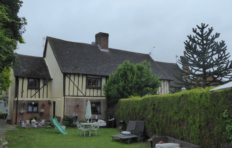
3 houses, formerly one dwelling. C17, incorporating part of a medieval open hall, with C19 and C20 alterations and additions. Timber framing, underbuilt in red brick at ground floor level, with painted smooth render to upper floor between studwork, and to gable ends. Plain tiled roof with central brick ridge stack. PLAN: linear range, with earlier central lobby entrance, now with lower added bays set back at either end. Late C20 extension to rear. FRONT (south-east) ELEVATION: 2 storeys, with central 3-bay range and single bay,2-storeyed additions. Upper floor framing of thin scantling, close studded, with diagonal tension braces to each corner and jowled corner posts, that to north-east gable of central range with a shallow curved brace Flemish bond brickwork to ground floor, incorporating vitrified header bricks to create a chequer-board pattern. Lower end bays with a matching pattern of brickwork and framing, with some replacement brickwork at the south-west end. Main range with central doorway with plank door, flanked by stacked 3-light casements, each light of 6 panes, beneath brick soldier arches, and with projecting timber cills. End bays with a 2-light casement to each floor, that to the north-east with a doorway. INTERIOR: not inspected, but known to contain items of interest, including the central hearth, spine beams and joists, and the central roof truss of the former open hall, incorporating shallow arch bracing and clasped purlins. HISTORY: the building is shown on an Enclosure map of 1817, and is described as The Workhouse.
Listing NGR: TL1264234071
External links are from the relevant listing authority and, where applicable, Wikidata. Wikidata IDs may be related buildings as well as this specific building. If you want to add or update a link, you will need to do so by editing the Wikidata entry.


Other nearby listed buildings