Approximate Location Map
Large Map »
Latitude: 52.6367 / 52°38'12"N
Longitude: -2.4636 / 2°27'48"W
OS Eastings: 368722
OS Northings: 304427
OS Grid: SJ687044
Mapcode National: GBR BX.6VKW
Mapcode Global: WH9D9.4Z3J
Plus Code: 9C4VJGPP+MH
Entry Name: The Hollies
Listing Date: 8 April 1983
Grade: II
Source: Historic England
Source ID: 1033282
English Heritage Legacy ID: 362352
ID on this website: 101033282
Location: Madeley, Telford and Wrekin, Shropshire, TF7
County: Telford and Wrekin
Civil Parish: Madeley
Built-Up Area: Telford
Traditional County: Shropshire
Lieutenancy Area (Ceremonial County): Shropshire
Church of England Parish: Madeley
Church of England Diocese: Hereford
Tagged with: Building
MADELEY PARK LANE
1.
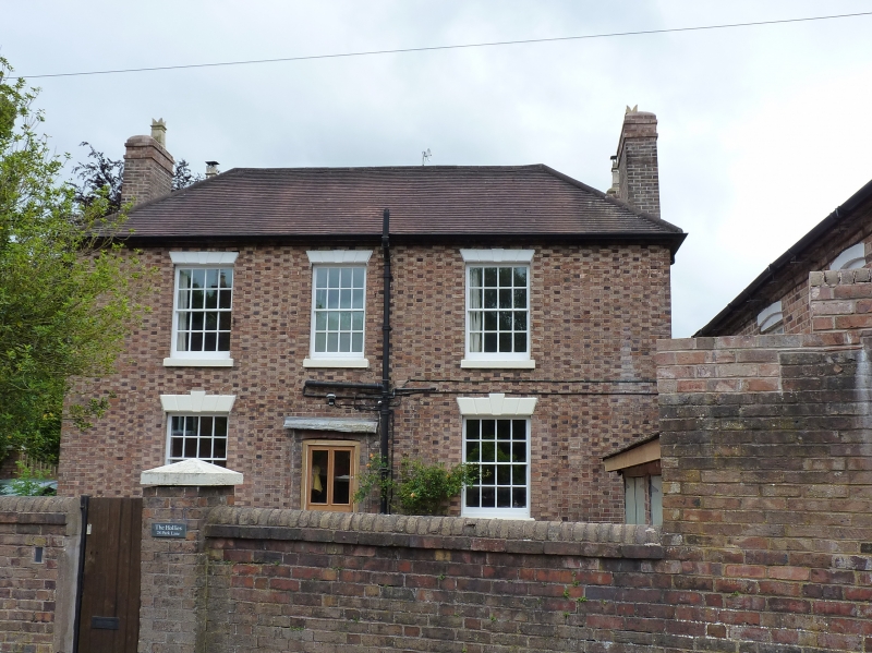
5362 The Hollies
SJ 60SE 33/500
II GV
2.
Early/mid C19 buff-coloured brick house with dark headers. New tile hipped roof.
Two-storeys. Three bays. Sashes with glazing bars and cast-iron segmental-arched
lintels with keyblocks. Central pilastered doorcase, with flat hood on console
brackets.
Listing NGR: SJ6872204427
External links are from the relevant listing authority and, where applicable, Wikidata. Wikidata IDs may be related buildings as well as this specific building. If you want to add or update a link, you will need to do so by editing the Wikidata entry.


Other nearby listed buildings
