Approximate Location Map
Large Map »
Latitude: 52.6348 / 52°38'5"N
Longitude: -2.4531 / 2°27'11"W
OS Eastings: 369432
OS Northings: 304216
OS Grid: SJ694042
Mapcode National: GBR BX.74SM
Mapcode Global: WH9DH.913D
Plus Code: 9C4VJGMW+WQ
Entry Name: Garden Boundary Wall South West of the Old Hall
Listing Date: 8 April 1983
Grade: II
Source: Historic England
Source ID: 1208661
English Heritage Legacy ID: 362322
ID on this website: 101208661
Location: Madeley, Telford and Wrekin, Shropshire, TF7
County: Telford and Wrekin
Civil Parish: Madeley
Built-Up Area: Telford
Traditional County: Shropshire
Lieutenancy Area (Ceremonial County): Shropshire
Church of England Parish: Madeley
Church of England Diocese: Hereford
Tagged with: Wall
MADELEY CHURCH STREET
1.
5362 Garden boundary wall south-
west of the Old Hall
SJ 6904SW 11/470
II GV
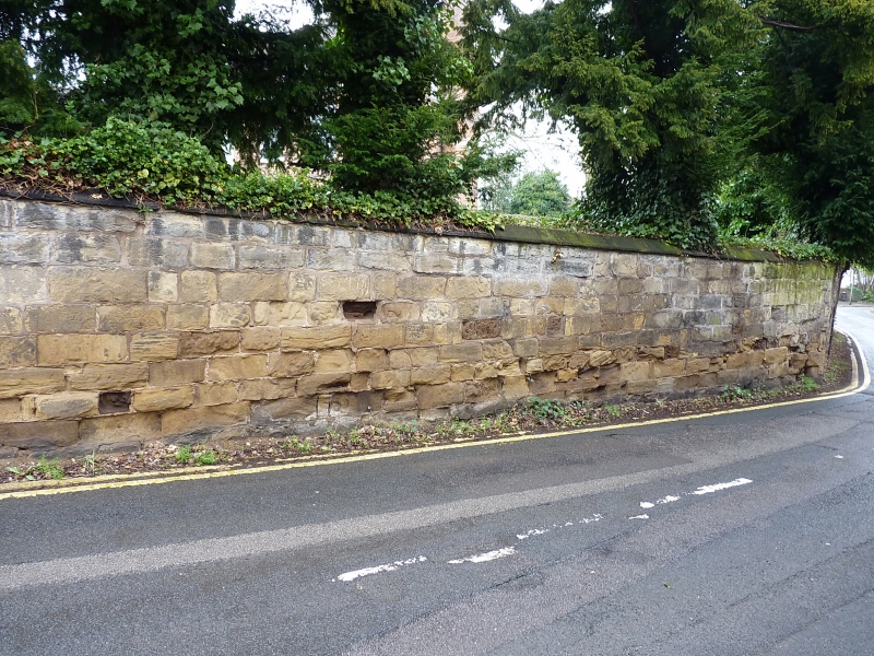
2.
Circa C18/19. Sandstone ashlar. High wall with chamfered coping. Follows curve
of road. Included for group value.
Listing NGR: SJ6943204216
External links are from the relevant listing authority and, where applicable, Wikidata. Wikidata IDs may be related buildings as well as this specific building. If you want to add or update a link, you will need to do so by editing the Wikidata entry.


Other nearby listed buildings
