Latitude: 52.6564 / 52°39'23"N
Longitude: -2.4473 / 2°26'50"W
OS Eastings: 369840
OS Northings: 306618
OS Grid: SJ698066
Mapcode National: GBR BY.5L7C
Mapcode Global: WH9D9.CHVC
Plus Code: 9C4VMH43+H3
Entry Name: Stables Immediately North West of Stirchley Hall Farmhouse
Listing Date: 8 April 1983
Grade: II
Source: Historic England
Source ID: 1033304
English Heritage Legacy ID: 362392
ID on this website: 101033304
Location: Town Park, Telford and Wrekin, Shropshire, TF3
County: Telford and Wrekin
Civil Parish: Stirchley and Brookside
Built-Up Area: Telford
Traditional County: Shropshire
Lieutenancy Area (Ceremonial County): Shropshire
Church of England Parish: Central Telford
Church of England Diocese: Lichfield
Tagged with: Stable
STIRCHLEY STIRCHLEY 1. 5362 Stirchley Road Stables immediately north- west of Stirchley Hall Farmhouse SJ 60NE 31/539
II GV
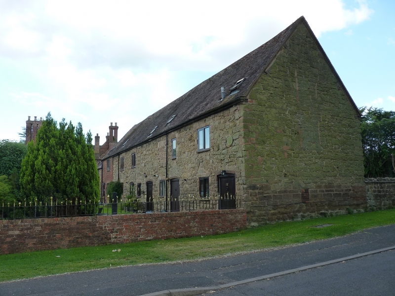
2. Circa C18/19 stone rubble stable range. Steeply pitched plain tile roof with gabled ends. Two-storeys. About 4 window range with brick one bay addition at south-east end. Two-light casements and boarded stable doors in segmental-headed openings. Included for group value.
Listing NGR: SJ6984006618
External links are from the relevant listing authority and, where applicable, Wikidata. Wikidata IDs may be related buildings as well as this specific building. If you want to add or update a link, you will need to do so by editing the Wikidata entry.


Other nearby listed buildings