Approximate Location Map
Large Map »
Latitude: 51.4868 / 51°29'12"N
Longitude: -1.8494 / 1°50'57"W
OS Eastings: 410553
OS Northings: 176440
OS Grid: SU105764
Mapcode National: GBR 3TT.M8H
Mapcode Global: VHB3R.WWNL
Plus Code: 9C3WF5P2+P6
Entry Name: The Cottage
Listing Date: 2 September 1986
Grade: II
Source: Historic England
Source ID: 1033843
English Heritage Legacy ID: 311281
ID on this website: 101033843
Location: Broad Hinton, Wiltshire, SN4
County: Wiltshire
Civil Parish: Broad Hinton
Built-Up Area: Broad Hinton
Traditional County: Wiltshire
Lieutenancy Area (Ceremonial County): Wiltshire
Tagged with: Cottage
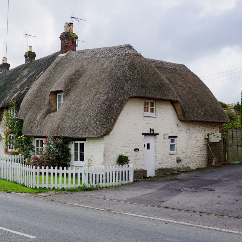
SU 17 NW BROAD HINTON VILLAGE CENTRE
(south end)
2/11 The Cottage
GV II
Cottage at end of row of 3. C18-early C19. Painted chalkstone,
thatched roof. Single storey and attic, 2 bays. Boarded central
door in timber porch. C19 casement windows. Stack on party wall
to left.
Listing NGR: SU1055376440
External links are from the relevant listing authority and, where applicable, Wikidata. Wikidata IDs may be related buildings as well as this specific building. If you want to add or update a link, you will need to do so by editing the Wikidata entry.


Other nearby listed buildings
