Latitude: 51.481 / 51°28'51"N
Longitude: -1.6208 / 1°37'14"W
OS Eastings: 426431
OS Northings: 175848
OS Grid: SU264758
Mapcode National: GBR 5XY.51M
Mapcode Global: VHC1J.V1JH
Plus Code: 9C3WF9JH+9M
Entry Name: 3, Crooked Corner
Listing Date: 22 August 1966
Grade: II
Source: Historic England
Source ID: 1034185
English Heritage Legacy ID: 310478
ID on this website: 101034185
Location: Aldbourne, Wiltshire, SN8
County: Wiltshire
Civil Parish: Aldbourne
Built-Up Area: Aldbourne
Traditional County: Wiltshire
Lieutenancy Area (Ceremonial County): Wiltshire
Tagged with: Building
SU 27 NE ALDBOURNE CROOKED CORNER (east side)
9/18 No 3 22.8.66
GV II
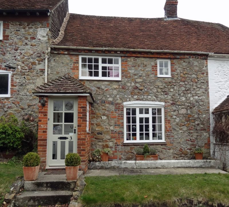
Cottage in row. Early C19. Sarsen with tiled roof. 2-storey, 1 bay with lateral entrance. 2 rooms deep. C20 glazed door on open hipped porch. Late C20 bow window with paired windows to first floor. Brick dentilled eaves. Stack on right party wall. Extensive C20 rear extensions. Listed for group value only.
Listing NGR: SU2643375844
External links are from the relevant listing authority and, where applicable, Wikidata. Wikidata IDs may be related buildings as well as this specific building. If you want to add or update a link, you will need to do so by editing the Wikidata entry.


Other nearby listed buildings