Approximate Location Map
Large Map »
Latitude: 51.481 / 51°28'51"N
Longitude: -1.6208 / 1°37'14"W
OS Eastings: 426429
OS Northings: 175853
OS Grid: SU264758
Mapcode National: GBR 5XY.51M
Mapcode Global: VHC1J.V1JG
Plus Code: 9C3WF9JH+CM
Entry Name: 4, Crooked Corner
Listing Date: 22 August 1966
Grade: II
Source: Historic England
Source ID: 1199664
English Heritage Legacy ID: 310479
ID on this website: 101199664
Location: Aldbourne, Wiltshire, SN8
County: Wiltshire
Civil Parish: Aldbourne
Built-Up Area: Aldbourne
Traditional County: Wiltshire
Lieutenancy Area (Ceremonial County): Wiltshire
Tagged with: Building
SU 27 NE ALDBOURNE CROOKED CORNER
(east side)
9/19 No 4
22.8.66
GV II
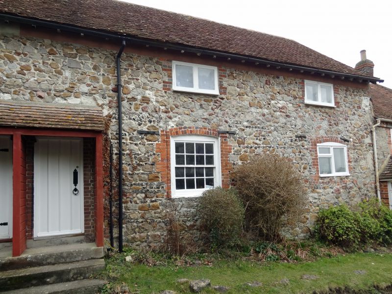
Cottage in row. C19. Sarsen, flint and brick, with tiled roof. 2-
storey, 2½ bays with left door under C20 tiled porch, one build
with No. 5 (q.v.). Various windows with brick jambs and segmental
heads, 16-pane to principal room. Open eaves. C20 2-storey hipped
rear extension. Stack opposite entrance, shared with No. 5. Listed
for group value only.
Listing NGR: SU2642875850
External links are from the relevant listing authority and, where applicable, Wikidata. Wikidata IDs may be related buildings as well as this specific building. If you want to add or update a link, you will need to do so by editing the Wikidata entry.


Other nearby listed buildings
