Latitude: 52.1367 / 52°8'12"N
Longitude: -1.5636 / 1°33'49"W
OS Eastings: 429962
OS Northings: 248798
OS Grid: SP299487
Mapcode National: GBR 5P3.1HF
Mapcode Global: VHBY8.VK7C
Plus Code: 9C4W4CPP+MG
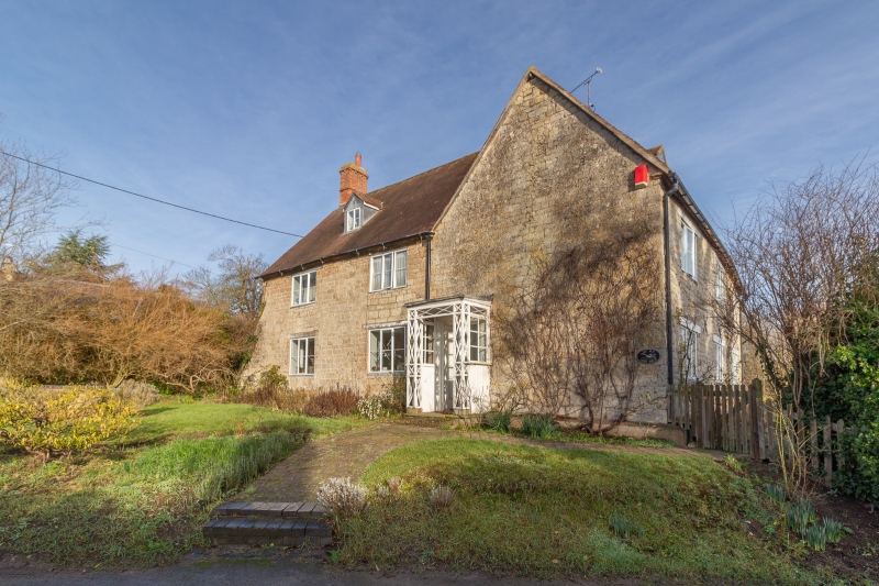
Entry Name: The Old Farmhouse
Listing Date: 23 February 1988
Grade: II
Source: Historic England
Source ID: 1035521
English Heritage Legacy ID: 307294
ID on this website: 101035521
Location: Pillerton Hersey, Stratford-on-Avon, Warwickshire, CV35
County: Warwickshire
District: Stratford-on-Avon
Civil Parish: Pillerton Hersey
Traditional County: Warwickshire
Lieutenancy Area (Ceremonial County): Warwickshire
Church of England Parish: Pillerton Hersey with Pillerton Priors
Church of England Diocese: Coventry
Tagged with: Farmhouse
PILLERTON HERSEY SP2948 11/55 The Old Farmhouse
GV II
House. C17 with C18 extensions. Squared, coursed limestone with quoins and ironstone and limestone plinth. Old tile roof with brick ridge and end stacks. 2 storeys plus attic; 3-window range. L-shaped plan. To C17 gable end facing front a 4-panelled door in panelled surround. C20 porch. To C18 range extending left 2 three-light casements to ground and first floors with wood lintels. One C19 gabled dormer. To opposite gable end of C17 range an ironstone 3-light mullioned window with hood mould and label stops. Interior: noted as having large open fireplace wth chamfered timber bressumer. Some chamfered spine beams.
Listing NGR: SP2996248798
External links are from the relevant listing authority and, where applicable, Wikidata. Wikidata IDs may be related buildings as well as this specific building. If you want to add or update a link, you will need to do so by editing the Wikidata entry.


Other nearby listed buildings