Latitude: 51.3123 / 51°18'44"N
Longitude: -1.9426 / 1°56'33"W
OS Eastings: 404096
OS Northings: 157021
OS Grid: SU040570
Mapcode National: GBR 3WT.MP9
Mapcode Global: VHB4P.88WV
Plus Code: 9C3W8364+WX
Entry Name: Two Chimneys
Listing Date: 25 March 1988
Grade: II
Source: Historic England
Source ID: 1035873
English Heritage Legacy ID: 312134
ID on this website: 101035873
Location: Urchfont, Wiltshire, SN10
County: Wiltshire
Civil Parish: Urchfont
Built-Up Area: Urchfont
Traditional County: Wiltshire
Lieutenancy Area (Ceremonial County): Wiltshire
Tagged with: Building Thatched cottage
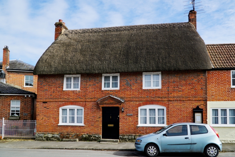
URCHFONT HIGH STREET SU 0457 (east side) 11/228 Two Chimneys GV II House. Early-mid C18. Greensand rubble, faced with Flemish bond brickwork, thatched roof. Two storeys and cellar, 3 bays. Central 4-panelled door, half glazed, with moulded brick dentilled triangular pediment, reset on brick brackets. Three-light timber windows to ground floor with wide segmental brick arches. Plat band. Two-light timber casement windows to upper floor. Gable stacks. Two storey early C20 extension to right, not of special interest.
Listing NGR: SU0409657021
External links are from the relevant listing authority and, where applicable, Wikidata. Wikidata IDs may be related buildings as well as this specific building. If you want to add or update a link, you will need to do so by editing the Wikidata entry.


Other nearby listed buildings