Latitude: 51.3118 / 51°18'42"N
Longitude: -1.9427 / 1°56'33"W
OS Eastings: 404087
OS Northings: 156971
OS Grid: SU040569
Mapcode National: GBR 3WT.MNC
Mapcode Global: VHB4P.89T5
Plus Code: 9C3W8364+PW
Entry Name: Urchfont House
Listing Date: 25 March 1988
Grade: II
Source: Historic England
Source ID: 1035879
English Heritage Legacy ID: 312143
ID on this website: 101035879
Location: Urchfont, Wiltshire, SN10
County: Wiltshire
Civil Parish: Urchfont
Built-Up Area: Urchfont
Traditional County: Wiltshire
Lieutenancy Area (Ceremonial County): Wiltshire
Tagged with: House
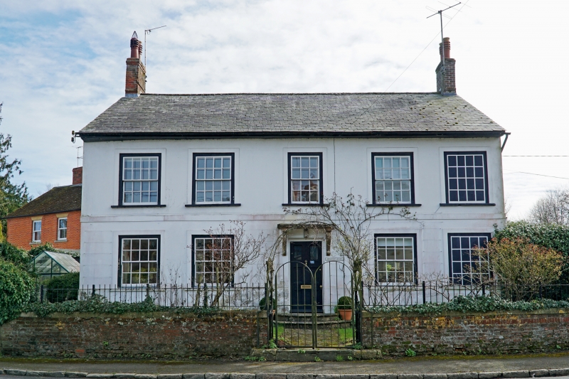
URCHFONT TOWNSEND SU 05 NW (north side) 2/237 Urchfont House GV II House. Late C18-early C19. Line rendered and colourwashed. Slate roof. Two storeys, 5 bays, 2 rooms deep. Elevation approximately symmetrical about 6-panelled door over 2 rounded steps. Stone moulded canopy on elongated consoles. Plat band. Sixteen-paned sashes within raised surrounds, the fifth, right, bay blind. Gable stacks.
Listing NGR: SU0408756971
External links are from the relevant listing authority and, where applicable, Wikidata. Wikidata IDs may be related buildings as well as this specific building. If you want to add or update a link, you will need to do so by editing the Wikidata entry.


Other nearby listed buildings