Latitude: 51.3134 / 51°18'48"N
Longitude: -1.9433 / 1°56'35"W
OS Eastings: 404047
OS Northings: 157142
OS Grid: SU040571
Mapcode National: GBR 3WT.MHF
Mapcode Global: VHB4P.88H0
Plus Code: 9C3W8374+9M
Entry Name: Beechcroft
Listing Date: 25 March 1988
Grade: II
Source: Historic England
Source ID: 1035874
English Heritage Legacy ID: 312136
ID on this website: 101035874
Location: Urchfont, Wiltshire, SN10
County: Wiltshire
Civil Parish: Urchfont
Built-Up Area: Urchfont
Traditional County: Wiltshire
Lieutenancy Area (Ceremonial County): Wiltshire
Tagged with: Building
URCHFONT HIGH STREET
SU 0457
(west side)
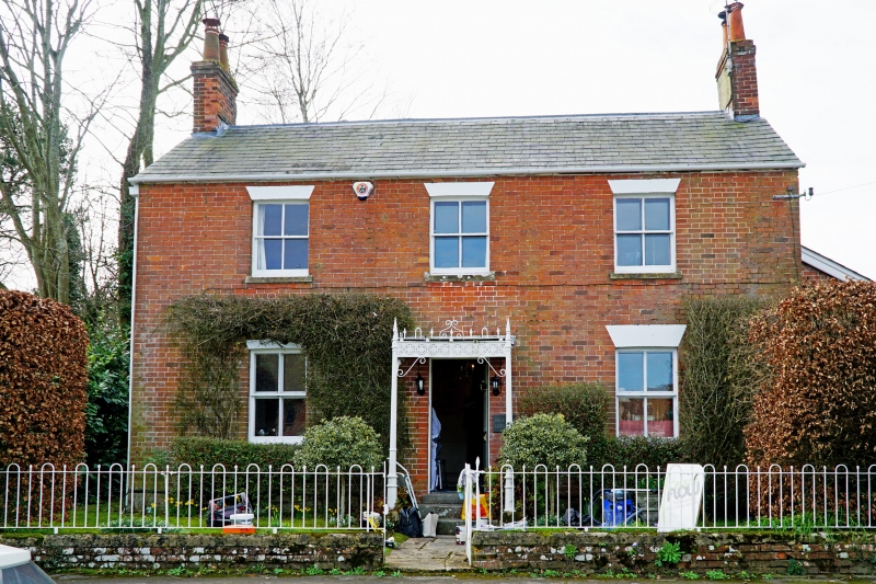
11/230 Beechcroft
II
House. Late C19. Brick, rendered on end, slate roof. Two
storeys, 3 bays. Central 6-panelled door with fine wrought iron
porch on fluted columns, perforated fascia with scrolled brackets,
and arrowhead and loop crestings. Four panelled sash windows and
gable stacks. Rear wing and lean-to on right.
Listing NGR: SU0404757142
External links are from the relevant listing authority and, where applicable, Wikidata. Wikidata IDs may be related buildings as well as this specific building. If you want to add or update a link, you will need to do so by editing the Wikidata entry.


Other nearby listed buildings