Latitude: 51.3706 / 51°22'14"N
Longitude: -1.68 / 1°40'47"W
OS Eastings: 422373
OS Northings: 163553
OS Grid: SU223635
Mapcode National: GBR 5Z7.227
Mapcode Global: VHC1W.TTQ5
Plus Code: 9C3W98CC+62
Entry Name: Wharf House
Listing Date: 13 June 1988
Grade: II
Source: Historic England
Source ID: 1035906
English Heritage Legacy ID: 312214
ID on this website: 101035906
Location: Ram Alley, Wiltshire, SN8
County: Wiltshire
Civil Parish: Burbage
Traditional County: Wiltshire
Lieutenancy Area (Ceremonial County): Wiltshire
Tagged with: House
BURBAGE BURBAGE WHARF SU 26 SW 2/4 Wharf House II
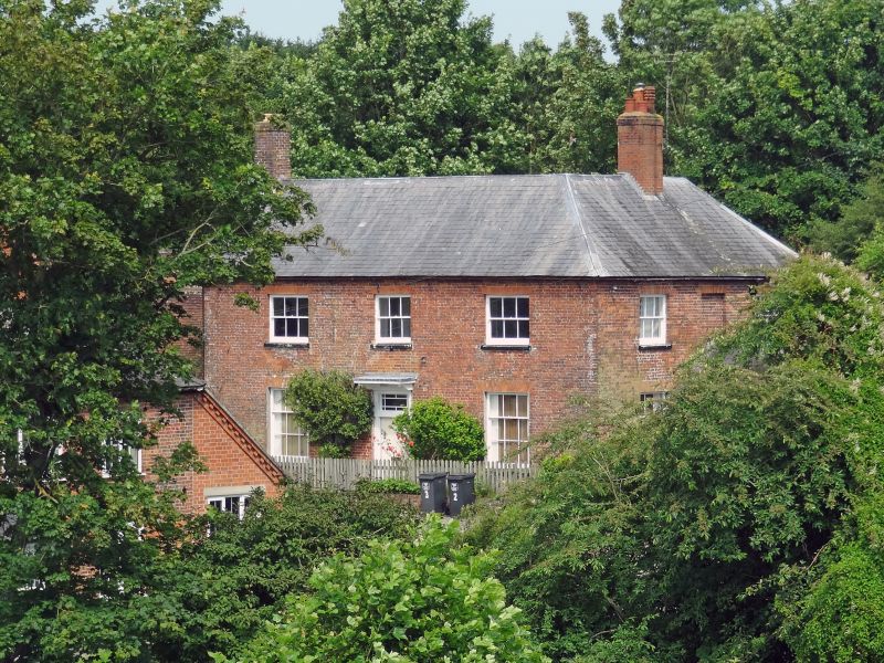
House. c1830. Flemish bond brickwork with slate roof. Two storeys, 3 bays. 'L' plan, returning on east to form a 2-bay elevation to road. Central 4-panelled door with margin glazed overlight. Nine-paned single hung sashes with gauged brick lintels to ground floor, 6-pane sashes to first floor and brick dentilled eaves. Roof hipped to right at return to rear wing. Gable stack to left, and single storey outbuilding with tiled roof and gable stack attached. Later C19 porch with shaped barge boards added to centre of return elevation.
Listing NGR: SU2237363553
External links are from the relevant listing authority and, where applicable, Wikidata. Wikidata IDs may be related buildings as well as this specific building. If you want to add or update a link, you will need to do so by editing the Wikidata entry.


Other nearby listed buildings