Latitude: 51.3483 / 51°20'54"N
Longitude: -2.2514 / 2°15'5"W
OS Eastings: 382584
OS Northings: 161059
OS Grid: ST825610
Mapcode National: GBR 1SC.FLR
Mapcode Global: VH96V.XCMQ
Plus Code: 9C3V8PXX+8C
Entry Name: Section of Elevated Pavement in Front of No 21, Plus Wall Running to Left, and Steps with Pathway Leading North Between No 21 and Nos 23 and 24
Listing Date: 23 August 1974
Grade: II
Source: Historic England
Source ID: 1036068
English Heritage Legacy ID: 312598
ID on this website: 101036068
Location: Bradford-on-Avon, Wiltshire, BA15
County: Wiltshire
Civil Parish: Bradford-on-Avon
Built-Up Area: Bradford on Avon
Traditional County: Wiltshire
Lieutenancy Area (Ceremonial County): Wiltshire
Church of England Parish: Bradford-on-Avon Holy Trinity
Church of England Diocese: Salisbury
Tagged with: Building
1. MARKET STREET 5411 (East Side)
Section of elevated pavement in front of No 21, plus wall running to left, and steps with pathway leading north between No 21 and Nos 23 and 24 ST 8261 1/190
II GV
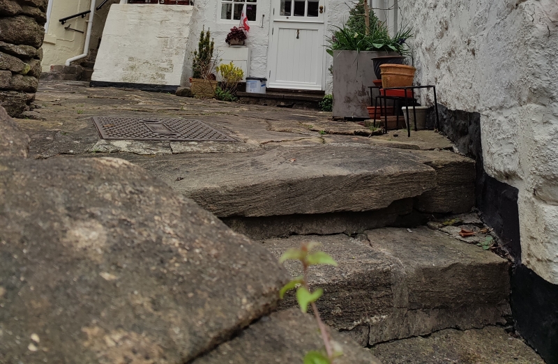
2. Midway up the hill, on the right-hand side, Market Street widens out to the east. In the angle where the street bends is a triangular section of elevated pavement in front of No 21. The elevated pavement (approximately 3ft above the level of the modern road) is of random rubble with paving stones on top. A stone wall, facing the street in front of No 20, runs to the left. The wall is of rubble blocks with stone cappings, rising up the hill from approximately 5 to 10ft in height. In this wall is set a large semi-circular arched recess. Ashlar dressings, with a square-headed opening filled by a metalwork grille. The section of elevated pavement is reached by a flight of 5 wide steps (now of concrete) to the right. These steps lead up to a sloping path of inset coursed rubble blocks. This path continues, with a few isolated steps, up between No 21 to left and Nos 23 and 24 to right, and passes through the passageway under the left hand side of No 23.
Nos 5 to 8 (consec) and Boundary wall at Priory Lodge form a group with Nos 10 to 35 (consec) and elevated pavement in front of No 21.
Listing NGR: ST8259961044
External links are from the relevant listing authority and, where applicable, Wikidata. Wikidata IDs may be related buildings as well as this specific building. If you want to add or update a link, you will need to do so by editing the Wikidata entry.


Other nearby listed buildings