Latitude: 51.9731 / 51°58'23"N
Longitude: 0.7764 / 0°46'35"E
OS Eastings: 590801
OS Northings: 234154
OS Grid: TL908341
Mapcode National: GBR RKP.C3N
Mapcode Global: VHKFJ.DNTS
Plus Code: 9F32XQFG+6H
Entry Name: Bures Baptist Church
Listing Date: 9 February 1978
Grade: II
Source: Historic England
Source ID: 1036678
English Heritage Legacy ID: 277897
ID on this website: 101036678
Location: Bures, Babergh, Suffolk, CO8
County: Suffolk
District: Babergh
Civil Parish: Bures St. Mary
Built-Up Area: Bures
Traditional County: Suffolk
Lieutenancy Area (Ceremonial County): Suffolk
Church of England Parish: Bures St Mary
Church of England Diocese: St.Edmundsbury and Ipswich
Tagged with: Protestant church building
HIGH STREET 1. 5377 (South-East Side) Bures St Mary Bures Baptist Church TL 9034 26/100 II GV
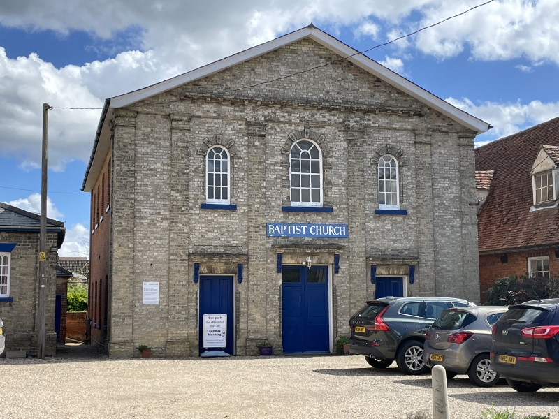
2. A red brick building with a grey gault brick front. Built in 1835. It stands set back from the road with a small sunday school of similar date on the north-east side. The front is divided by pilasters rising through 2 storeys, with moulded caps and bases. 3 window range, casements with semi-circular arched heads with rusticated voussoirs. The centre window is larger and has rustications to the reveals also. 3 doorways with cornice hoods on console brackets. The centre doorway is larger and double. Roof slate.
Listing NGR: TL9080134154
External links are from the relevant listing authority and, where applicable, Wikidata. Wikidata IDs may be related buildings as well as this specific building. If you want to add or update a link, you will need to do so by editing the Wikidata entry.


Other nearby listed buildings