Latitude: 51.9733 / 51°58'23"N
Longitude: 0.7758 / 0°46'32"E
OS Eastings: 590759
OS Northings: 234171
OS Grid: TL907341
Mapcode National: GBR RKP.BYX
Mapcode Global: VHKFJ.DNHN
Plus Code: 9F32XQFG+88
Entry Name: The Old Bakery
Listing Date: 10 January 1973
Last Amended: 9 February 1978
Grade: II*
Source: Historic England
Source ID: 1351766
English Heritage Legacy ID: 277889
ID on this website: 101351766
Location: Bures, Babergh, Suffolk, CO8
County: Suffolk
District: Babergh
Civil Parish: Bures St. Mary
Built-Up Area: Bures
Traditional County: Suffolk
Lieutenancy Area (Ceremonial County): Suffolk
Church of England Parish: Bures St Mary
Church of England Diocese: St.Edmundsbury and Ipswich
Tagged with: Architectural structure
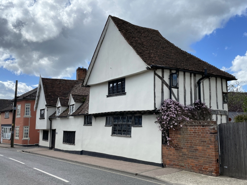
HIGH STREET 1. 5377 (North-West Side) Bures St Mary The Old Bakery (formerly listed as House and baker's shop opposite, and north of malthouse and House adjoining and on East of baker's shop) TL 9034 26/92 10.1.73. II* GV
2. The house now known as The Old Bakery formerly comprised 2 tenements, one to the south-west, a C16 timber-framed and plastered house with a cross wing at the south-west end jettied on the 1st storey. The main block is 1 storey and attics and the cross wing is 2 storeys. The other is a C17 timber-framed and plastered house with exposed timber-framing, gabled on the front with the upper storey jettied on exposed joists. The gable is also jettied. The windows are casements with leaded lights. Roofs tiled, with 2 gabled dormers and a large square chimney stack to the main block. The interior has exposed timber-framing, ceiling beams and joists, some moulded. There is a Tudor doorway with castellated doorhead, carved with roses.
Listing NGR: TL9075934171
External links are from the relevant listing authority and, where applicable, Wikidata. Wikidata IDs may be related buildings as well as this specific building. If you want to add or update a link, you will need to do so by editing the Wikidata entry.


Other nearby listed buildings