Latitude: 51.9719 / 51°58'18"N
Longitude: 0.7747 / 0°46'28"E
OS Eastings: 590686
OS Northings: 234021
OS Grid: TL906340
Mapcode National: GBR RKP.BNJ
Mapcode Global: VHKFJ.CPXP
Plus Code: 9F32XQCF+QV
Entry Name: Church of St Mary the Virgin
Listing Date: 23 March 1961
Grade: I
Source: Historic England
Source ID: 1036711
English Heritage Legacy ID: 277875
Also known as: St Mary's Church, Bures St. Mary
ID on this website: 101036711
Location: St Mary's Church, Bures, Babergh, Suffolk, CO8
County: Suffolk
District: Babergh
Civil Parish: Bures St. Mary
Built-Up Area: Bures
Traditional County: Suffolk
Lieutenancy Area (Ceremonial County): Suffolk
Church of England Parish: Bures St Mary
Church of England Diocese: St.Edmundsbury and Ipswich
Tagged with: Church building
BRIIGE STREET 1. 5377 Bures St Mary Church of St Mary the Virgin TL 9034 26/78 23.3.61. I GV
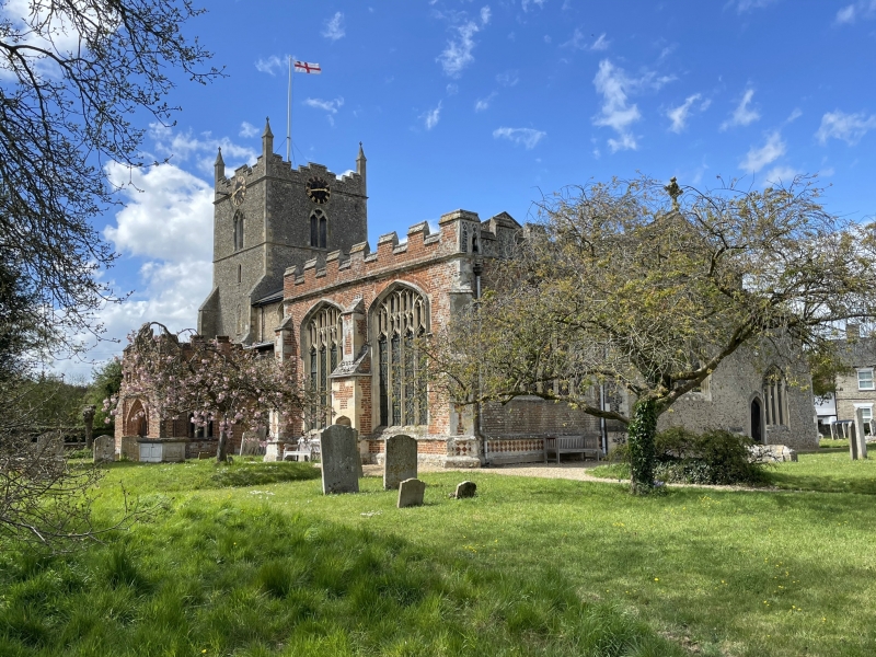
2. A flint and stone church, mainly of C14 work with C16 alterations and additions. There is a reference to "St Mary in Buri" dated 1075 indicating the existance of an earlier church on this site. The west tower is late C13 to early C14, with angle buttresses and a stepped parapet. The tower was originally surmounted by a spire which was destroyed by lightning in 1733. The north porch is a fine example of C14 work with heavy timbers and 8-light open tracery on the sides. The gable has original cusped bargeboards. The south porch is early C16 red brick with a crowstepped gable and a castellated parapet with machicolation. The sides have windows with Perpendicular tracery. The Waldegrave Chapel was built by Sir William Waldegrave circa 1514. The nave has original roof corbels carved as angels. The font is C16, octagonal, with the Tudor arms and armorial shields dates circa 1545. The monuments include a fine early C14 wooden effigy of a knight and a number to members of the Waldegrave family. Graded for its architectural, historical and topographical value.
Listing NGR: TL9068634021
External links are from the relevant listing authority and, where applicable, Wikidata. Wikidata IDs may be related buildings as well as this specific building. If you want to add or update a link, you will need to do so by editing the Wikidata entry.


Other nearby listed buildings