Approximate Location Map
Large Map »
Latitude: 52.6273 / 52°37'38"N
Longitude: -2.4835 / 2°29'0"W
OS Eastings: 367366
OS Northings: 303396
OS Grid: SJ673033
Mapcode National: GBR BW.7H9R
Mapcode Global: WH9DG.T7K4
Plus Code: 9C4VJGG8+WH
Entry Name: 14, Severnside
Listing Date: 8 April 1983
Grade: II
Source: Historic England
Source ID: 1038665
English Heritage Legacy ID: 362210
ID on this website: 101038665
Location: Ironbridge, Telford and Wrekin, Shropshire, TF8
County: Telford and Wrekin
Civil Parish: The Gorge
Built-Up Area: Telford
Traditional County: Shropshire
Lieutenancy Area (Ceremonial County): Shropshire
Church of England Parish: Ironbridge
Church of England Diocese: Hereford
Tagged with: Building
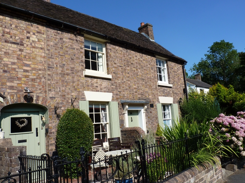
IRONBRIDGE SEVERNSIDE
1.
5362 No 14
SJ 6703 SW 15/354
II GV
2.
Early C19 brick cottage. Plain tile roof with gabled ends. Two storeys. Two
windows. Sashes with glazing bars, and plain stone lintels, flush panel shutters
to ground floor windows. Central pilastered doorcase with moulded hoods on shaped
brackets and flush panel door. Brick end stack.
Listing NGR: SJ6736603396
External links are from the relevant listing authority and, where applicable, Wikidata. Wikidata IDs may be related buildings as well as this specific building. If you want to add or update a link, you will need to do so by editing the Wikidata entry.


Other nearby listed buildings
