Approximate Location Map
Large Map »
Latitude: 52.6046 / 52°36'16"N
Longitude: -1.7065 / 1°42'23"W
OS Eastings: 419972
OS Northings: 300802
OS Grid: SK199008
Mapcode National: GBR 4FS.MCL
Mapcode Global: WHCH3.RSKL
Plus Code: 9C4WJ73V+V9
Entry Name: Drayton Footbridge
Listing Date: 29 October 1987
Grade: II
Source: Historic England
Source ID: 1038818
English Heritage Legacy ID: 272768
ID on this website: 101038818
Location: Drayton Bassett, Lichfield, Staffordshire, B78
County: Staffordshire
District: Lichfield
Civil Parish: Drayton Bassett
Traditional County: Staffordshire
Lieutenancy Area (Ceremonial County): Staffordshire
Church of England Parish: Drayton Bassett St Peter
Church of England Diocese: Lichfield
Tagged with: Footbridge
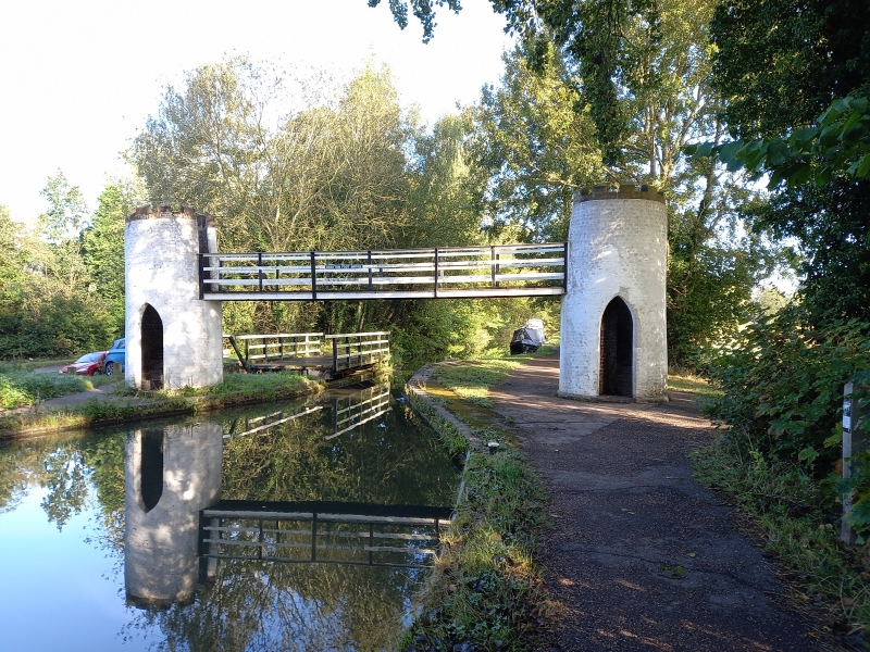
SK 1800-1900 DRAYTON BASSETT C.P. BIRMINGHAM AND
FAZELEY CANAL
14/16 Drayton Footbridge
-
GV II
Footbridge. Late C18. Red brick, painted white externally; stone
parapet. A pair of cylindrical stair turrets flank the canal and are
linked by a footbridge, each turret has a pointed arch doorway and
a crenellated parapet. The Minworth to Fazeley branch of the Birmingham
and Fazeley Canal, which Drayton Footbridge serves, was completed
in 1789; the contractor was John Pinkerton. S. R. Broadbridge, The
Birmingham Canal Navigations, Vol. I 1768-1846 (1974) pp.38-45.
Listing NGR: SK1997200802
External links are from the relevant listing authority and, where applicable, Wikidata. Wikidata IDs may be related buildings as well as this specific building. If you want to add or update a link, you will need to do so by editing the Wikidata entry.


Other nearby listed buildings
