Latitude: 51.2451 / 51°14'42"N
Longitude: 1.3076 / 1°18'27"E
OS Eastings: 630945
OS Northings: 154750
OS Grid: TR309547
Mapcode National: GBR X1F.TP5
Mapcode Global: VHLGR.MY4V
Plus Code: 9F3368W5+33
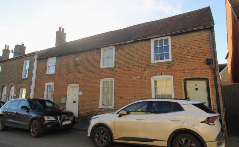
Entry Name: Number 5 (Zephyrine) and Number 6
Listing Date: 10 August 1977
Grade: II
Source: Historic England
Source ID: 1039092
English Heritage Legacy ID: 178180
ID on this website: 101039092
Location: Eastry, Dover, Kent, CT13
County: Kent
District: Dover
Civil Parish: Eastry
Built-Up Area: Eastry
Traditional County: Kent
Lieutenancy Area (Ceremonial County): Kent
Tagged with: Building
TR 3054 EASTRY HIGH STREET
(west side) 12/149 No 5 (Zephyrine), No 6 10.8.77
GV II
Cottage pair. C18.Red brick and plain tiled roof. Two storeys on flint plinth, the upper storey of very irregular bonding. Brick dentil eaves cornice to roof with stacks to rear. Three, glazing bar sashes on each floor, those on ground floor with segmental heads. Doors of 6 raised and fielded panels to left and to right with segmental heads. Basement opening, to centre.
Listing NGR: TR3094154748
External links are from the relevant listing authority and, where applicable, Wikidata. Wikidata IDs may be related buildings as well as this specific building. If you want to add or update a link, you will need to do so by editing the Wikidata entry.


Other nearby listed buildings