Latitude: 51.2453 / 51°14'43"N
Longitude: 1.3077 / 1°18'27"E
OS Eastings: 630946
OS Northings: 154769
OS Grid: TR309547
Mapcode National: GBR X1F.TP4
Mapcode Global: VHLGR.MY5Q
Plus Code: 9F3368W5+43
Entry Name: The General Stores
Listing Date: 26 November 1987
Grade: II
Source: Historic England
Source ID: 1070183
English Heritage Legacy ID: 178179
ID on this website: 101070183
Location: Eastry, Dover, Kent, CT13
County: Kent
District: Dover
Civil Parish: Eastry
Built-Up Area: Eastry
Traditional County: Kent
Lieutenancy Area (Ceremonial County): Kent
Tagged with: Building
This list entry was subject to a Minor Amendment on 31 March 2026 to amend the name and address and reformat the text to current standards
TR 3054
12/148
EASTRY
HIGH STREET (west side)
Nos 7, 8 and 9
Former General Stores
(Formerly listed as The General Stores, HIGH STREET)
GV
II
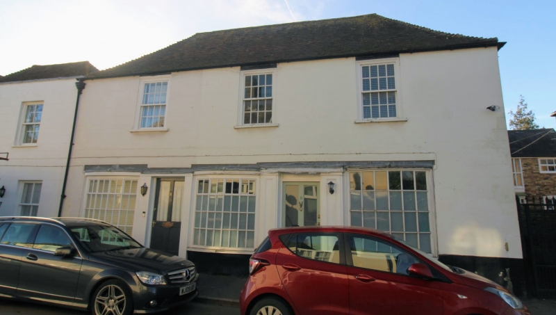
House and shop. C18 extended mid C19.Channelled render and plain tiled roof. Two storeys and basement on plinth with hipped roof and stack to rear. Three sashes on first floor. Recessed half-glazed door to centre with projecting plate glass windows either side. Blocked doorway to right with rectangular fanlight and bow window of twenty panes. Basement openings. Mid C19 extension to left, two storeys and parapet to hipped roof with two wooden casements on first floor and two plate glass windows on ground floor with tented corrugated iron verandah on brackets with valancing.
Listing NGR: TR3094654769
External links are from the relevant listing authority and, where applicable, Wikidata. Wikidata IDs may be related buildings as well as this specific building. If you want to add or update a link, you will need to do so by editing the Wikidata entry.


Other nearby listed buildings