Latitude: 52.7246 / 52°43'28"N
Longitude: -2.1114 / 2°6'41"W
OS Eastings: 392569
OS Northings: 314107
OS Grid: SJ925141
Mapcode National: GBR 297.10Z
Mapcode Global: WHBF6.JSR4
Plus Code: 9C4VPVFQ+RC
Entry Name: Wyre Hall and Attached Wall and Railings to the East
Listing Date: 27 October 1982
Last Amended: 2 January 1986
Grade: II
Source: Historic England
Source ID: 1039219
English Heritage Legacy ID: 271696
ID on this website: 101039219
Location: Penkridge, South Staffordshire, ST19
County: Staffordshire
District: South Staffordshire
Civil Parish: Penkridge
Built-Up Area: Penkridge
Traditional County: Staffordshire
Lieutenancy Area (Ceremonial County): Staffordshire
Church of England Parish: Penkridge St Michael and All Angels
Church of England Diocese: Lichfield
Tagged with: Building
SJ 9214-9314 PENKRIDGE C.P. CANNOCK ROAD (South side)
9/47 Wyre Hall and attached wall and railings to the east 27.10.82 (Previously listed as 'Wyre Hall')
GV II
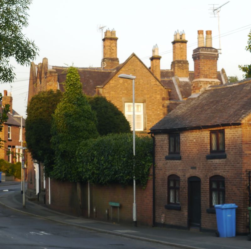
House, wall and railings. Late C17 with C18 and C19 additions and early to mid-C19 alterations. Red brick, English stretcher bond with additions in Flemish bond, ashlar quoins and dressings; plain tile roof with coped verges on kneelers; brick ridge stacks and corner stack, all with octagonal shafts. C17 block of 2 parallel ranges to the north-west aligned north-south facing north, C18 wing to east aligned north-south, projecting south, further extensions to the south. Gabled C18 wing to left of 2 storeys and one bay, and chamfered quoins of unequal length, C19 wooden frame cross windows with dripstone bands; C17 block to right of 3 storeys and 2 gabled bays with high stone plinth and quoins of unequal length, chamfer mullioned windows containing C19 wooden casements with decorative glazing bars, those to first floor have 3 lights and a moulded sill band, those to second floor have 2 lights, large C19 mullioned and transomed window to ground floor right; C19 6-panelled door to left with panelled doorcase, flanked by small fixed light windows, corner chimney to the right, formerly matched by one to the left. East elevation: 2 storeys with moulded plinth, first floor band, moulded eaves cornice and chamfered quoins of unequal length; 3 windows, C19 mullioned and transomed to centre, cross-windows to first floor left and right, canted bay window to ground floor right; blind gabled extension to ground floor left. Interior: 2 re-used medieval roof trusses over the east wing with cusped braces extending from tie beam to slightly curved truncated principals. A dwarf wall and C19 cast iron railings extend from the north-eastern angle of the house for approximately 10 yards to partially enclose a small courtyard.
Listing NGR: SJ9256914107
External links are from the relevant listing authority and, where applicable, Wikidata. Wikidata IDs may be related buildings as well as this specific building. If you want to add or update a link, you will need to do so by editing the Wikidata entry.


Other nearby listed buildings