Latitude: 52.027 / 52°1'37"N
Longitude: -1.1488 / 1°8'55"W
OS Eastings: 458495
OS Northings: 236853
OS Grid: SP584368
Mapcode National: GBR 8VS.Y35
Mapcode Global: VHCWK.19JY
Plus Code: 9C4W2VG2+RF
Entry Name: 23-29, Market Place
Listing Date: 17 July 1975
Grade: II
Source: Historic England
Source ID: 1040550
English Heritage Legacy ID: 233879
ID on this website: 101040550
Location: Brackley, West Northamptonshire, NN13
County: West Northamptonshire
Civil Parish: Brackley
Built-Up Area: Brackley
Traditional County: Northamptonshire
Lieutenancy Area (Ceremonial County): Northamptonshire
Church of England Parish: Brackley
Church of England Diocese: Peterborough
Tagged with: Building
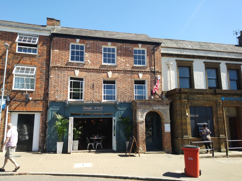
BRACKLEY MARKET PLACE
1.
5328
(East Side)
SP 5836 1/34 17.7.75. Nos 23 to 29 (odd)
II GV
2.
Row of 4 buildings with 3 shop fronts to ground floors. 2-storeyed C18-19 variegated
brick with Welsh slate roofs and moulded cornices. Brick stacks. Sash windows
with brick keystoned architraves. The north side and east back of No 29 are
of rubble.
Listing NGR: SP5849536853
External links are from the relevant listing authority and, where applicable, Wikidata. Wikidata IDs may be related buildings as well as this specific building. If you want to add or update a link, you will need to do so by editing the Wikidata entry.


Other nearby listed buildings