Latitude: 52.0298 / 52°1'47"N
Longitude: -1.1462 / 1°8'46"W
OS Eastings: 458673
OS Northings: 237166
OS Grid: SP586371
Mapcode National: GBR 8VS.R0Q
Mapcode Global: VHCWK.27XS
Plus Code: 9C4W2VH3+WG
Entry Name: 31, High Street
Listing Date: 16 June 1977
Grade: II
Source: Historic England
Source ID: 1040575
English Heritage Legacy ID: 233836
ID on this website: 101040575
Location: Brackley, West Northamptonshire, NN13
County: West Northamptonshire
Civil Parish: Brackley
Built-Up Area: Brackley
Traditional County: Northamptonshire
Lieutenancy Area (Ceremonial County): Northamptonshire
Church of England Parish: Brackley
Church of England Diocese: Peterborough
Tagged with: Building
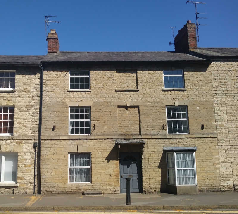
BRACKLEY HIGH STREET
1.
5328
(East Side)
No 31
SP 5837 2/94
II GV
2.
C18. Coursed rubble, Welsh slated roof, 3 storeys. 2 sash windows and central
dumny window, keystones and stone lintels. Stone bracketed doorhood. Canted
bay window on right of doorway.
Listing NGR: SP5867337166
External links are from the relevant listing authority and, where applicable, Wikidata. Wikidata IDs may be related buildings as well as this specific building. If you want to add or update a link, you will need to do so by editing the Wikidata entry.


Other nearby listed buildings