Approximate Location Map
Large Map »
Latitude: 52.0292 / 52°1'45"N
Longitude: -1.1464 / 1°8'46"W
OS Eastings: 458661
OS Northings: 237098
OS Grid: SP586370
Mapcode National: GBR 8VS.QZJ
Mapcode Global: VHCWK.28T8
Plus Code: 9C4W2VH3+MF
Entry Name: The Plough Inn
Listing Date: 16 June 1977
Grade: II
Source: Historic England
Source ID: 1189825
English Heritage Legacy ID: 233834
Also known as: Plough
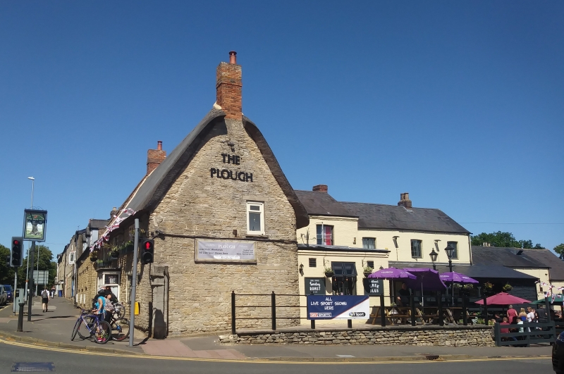
The Plough, Brackley
ID on this website: 101189825
Location: Brackley, West Northamptonshire, NN13
County: West Northamptonshire
Civil Parish: Brackley
Built-Up Area: Brackley
Traditional County: Northamptonshire
Lieutenancy Area (Ceremonial County): Northamptonshire
Church of England Parish: Brackley
Church of England Diocese: Peterborough
Tagged with: Pub Inn Thatched pub
BRACKLEY HIGH STREET
1.
5328
(East Side)
No 9 (The Plough
Inn)
SP 5837 2/39
II
2.
Possibly originally C17 but remodelled. 2 storeys, coursed rubble, thatched
roof. Red brick chimney stacks. 3 triple light modern casement windows. Small
ground floor bay window.
Listing NGR: SP5866137098
External links are from the relevant listing authority and, where applicable, Wikidata. Wikidata IDs may be related buildings as well as this specific building. If you want to add or update a link, you will need to do so by editing the Wikidata entry.


Other nearby listed buildings
