Approximate Location Map
Large Map »
Latitude: 52.3034 / 52°18'12"N
Longitude: -0.6764 / 0°40'35"W
OS Eastings: 490344
OS Northings: 268081
OS Grid: SP903680
Mapcode National: GBR DYF.HT3
Mapcode Global: VHFPC.7C7J
Plus Code: 9C4X883F+9C
Entry Name: Goods Shed Approximately 20 Metres South of Wellingborough Station
Listing Date: 5 May 1981
Last Amended: 12 March 1986
Grade: II
Source: Historic England
Source ID: 1040597
English Heritage Legacy ID: 233788
ID on this website: 101040597
Location: North Northamptonshire, NN8
County: North Northamptonshire
Electoral Ward/Division: Victoria
Parish: Non Civil Parish
Built-Up Area: Wellingborough
Traditional County: Northamptonshire
Lieutenancy Area (Ceremonial County): Northamptonshire
Church of England Parish: Wellingborough St Mary the Virgin
Church of England Diocese: Peterborough
Tagged with: Goods shed
WELLINGBOROUGH MIDLAND ROAD
SP96NW (South side)
5/130 Goods shed approx. 20m. S of
05/05/81 Wellingborough station
(Formerly listed as goods shed
at Wellingborough Station)
GV II
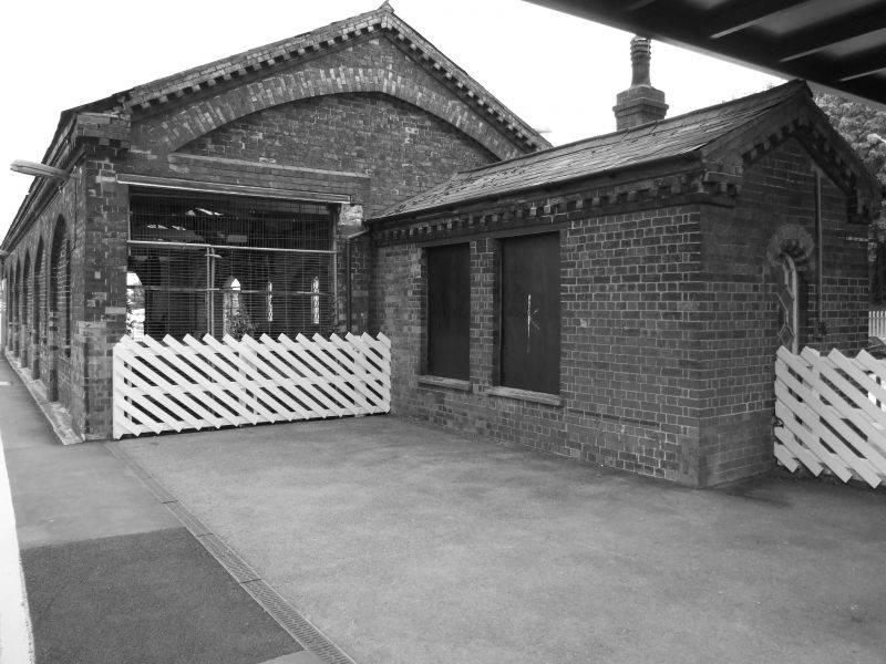
Goods shed. c.1857, by C.H. Driver. Red brick with yellow and blue brick
dressings and slate roof. Single unit plan. Single storey. Elevation to former
goods yard of 6 bays of blank arcade of pointed arches with loading bay openings
between second and fourth arches and single-light arch-head windows to other
arches. All with Midland Railway style, cast iron lozenge glazing. Gable end to
right has C20 modified entrance. Elevation to platform is similar with blank
arcades and single-light windows. Interior retains loading bays and original
wooden roof structure with cast-iron columns which support 2 hand cranes which
are attached to the building.
Listing NGR: SP9034468081
External links are from the relevant listing authority and, where applicable, Wikidata. Wikidata IDs may be related buildings as well as this specific building. If you want to add or update a link, you will need to do so by editing the Wikidata entry.


Other nearby listed buildings
