Latitude: 52.1035 / 52°6'12"N
Longitude: -0.9495 / 0°56'58"W
OS Eastings: 472051
OS Northings: 245540
OS Grid: SP720455
Mapcode National: GBR BXY.0SM
Mapcode Global: VHDSQ.HDF9
Plus Code: 9C4X4332+C6
Entry Name: The Hunt House
Listing Date: 1 December 1951
Last Amended: 22 June 1987
Grade: II
Source: Historic England
Source ID: 1041111
English Heritage Legacy ID: 234556
ID on this website: 101041111
Location: Paulerspury, West Northamptonshire, NN12
County: West Northamptonshire
Civil Parish: Paulerspury
Built-Up Area: Paulerspury
Traditional County: Northamptonshire
Lieutenancy Area (Ceremonial County): Northamptonshire
Church of England Parish: Paulerspury St James the Great
Church of England Diocese: Peterborough
Tagged with: House
PAULERSPURY HIGH STREET SP74NW (North side) 4/46 The Hunt House 01/12/51 (Formerly listed as Stable House)
- II
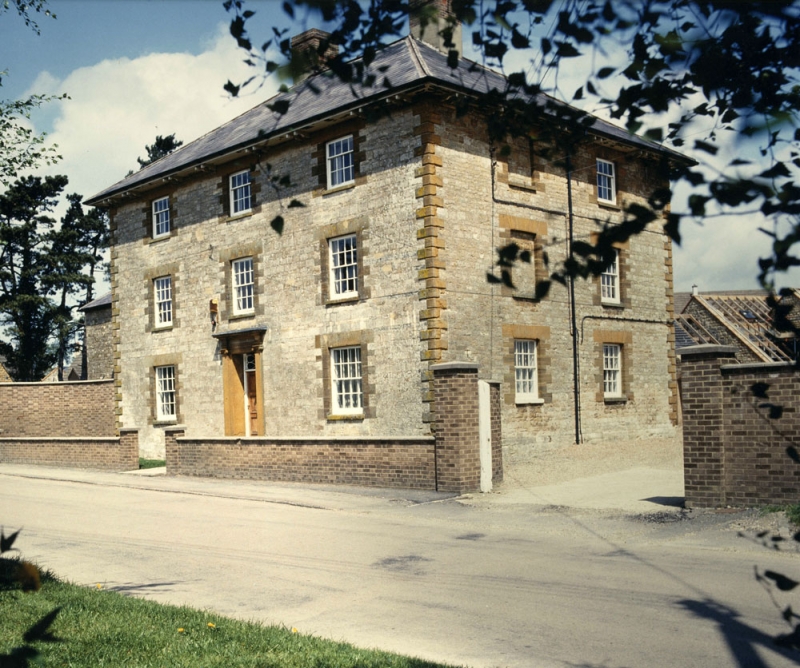
Farmhouse, now offices. c.1840. Limestone ashlar with ironstone dressings, hipped slate roof, brick internal stacks. Double-depth plan. 3-storey, 3-window range. Central 6-panel door with ornamental overlight in stone surround, with Ionic pilasters supporting entablature. 16-pane sash windows throughout with ironstone sills, jambs and flat-arched heads. Chamfered quoins and bracketed eaves. 2-storey wing to left and C20 extension to rear. Interior has open-well staircase from ground to second floors with stick balusters, carved tread ends and ramped mahogany handrail. Formerly the headquarters of the Grafton Hunt and one of a set of estate buildings erected for the Duke of Grafton. It now houses the Henry Royce Foundation. (Buildings of England: Northamptonshire, p.371)
Listing NGR: SP7205145540
External links are from the relevant listing authority and, where applicable, Wikidata. Wikidata IDs may be related buildings as well as this specific building. If you want to add or update a link, you will need to do so by editing the Wikidata entry.


Other nearby listed buildings