Latitude: 55.0808 / 55°4'50"N
Longitude: -1.4992 / 1°29'57"W
OS Eastings: 432069
OS Northings: 576378
OS Grid: NZ320763
Mapcode National: GBR K9ZP.7G
Mapcode Global: WHC36.YK8B
Plus Code: 9C7W3GJ2+88
Entry Name: Farmbuilding at Seaton Village Farm on East of Drive North of Pond
Listing Date: 15 July 1987
Grade: II
Source: Historic England
Source ID: 1041318
English Heritage Legacy ID: 236045
ID on this website: 101041318
Location: Seaton, Northumberland, NE26
County: Northumberland
Civil Parish: Seaton Valley
Traditional County: Northumberland
Lieutenancy Area (Ceremonial County): Northumberland
Church of England Parish: Delaval Our Lady
Church of England Diocese: Newcastle
Tagged with: Agricultural structure
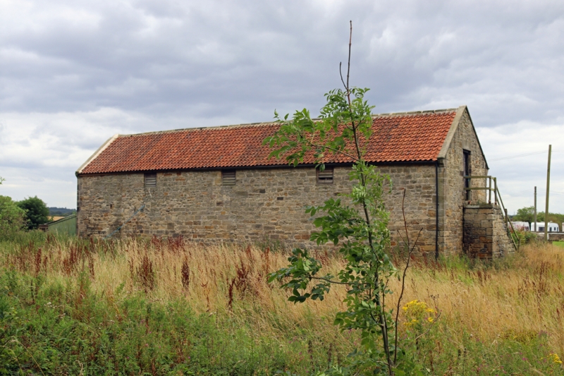
SEATON DELAVAL A 190 NZ 3276 (South side, off) The Avenue 13/81 Farmbuilding at Seaton Village Farm, on east of drive, north of pond GV II Shelter sheds with granary over, early C19. Roughly-squared stone with tooled- and-margined quoins and dressings, rear outshut heightened in brick; pantile roof. 2 storeys, 6 bays. Arcade of elliptical arches with raised keystones, 3 slatted windows with slightly-projecting sills above. Coped gables with moulded kneelers. External stone stair to boarded granary door on right return.
Listing NGR: NZ3206976378
External links are from the relevant listing authority and, where applicable, Wikidata. Wikidata IDs may be related buildings as well as this specific building. If you want to add or update a link, you will need to do so by editing the Wikidata entry.


Other nearby listed buildings