Approximate Location Map
Large Map »
Latitude: 55.0856 / 55°5'8"N
Longitude: -1.5832 / 1°34'59"W
OS Eastings: 426706
OS Northings: 576876
OS Grid: NZ267768
Mapcode National: GBR K9DM.1R
Mapcode Global: WHC35.NFBN
Plus Code: 9C7W3CP8+6P
Entry Name: Gray Tomb 13 Metres South of Church of St Nicholas
Listing Date: 15 July 1987
Grade: II
Source: Historic England
Source ID: 1041353
English Heritage Legacy ID: 236027
ID on this website: 101041353
Location: St Nicholas's Church, Hall Close Green, Northumberland, NE23
County: Northumberland
Civil Parish: Cramlington
Built-Up Area: Cramlington
Traditional County: Northumberland
Lieutenancy Area (Ceremonial County): Northumberland
Church of England Parish: Cramlington St Nicholas
Church of England Diocese: Newcastle
Tagged with: Tomb
CRAMLINGTON CRAMLINGTON VILLAGE
NZ 27 NE
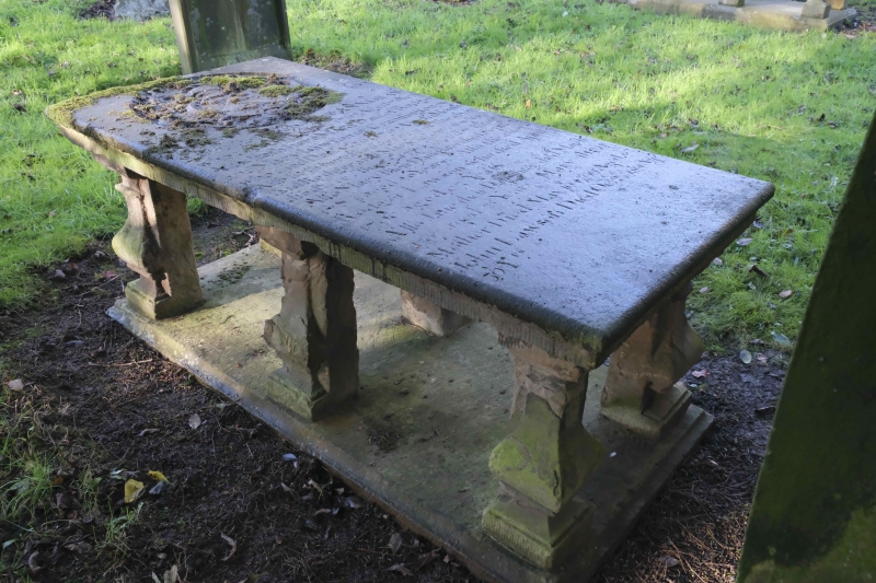
4/63 Gray tomb 13 metres
south of Church of
St. Nicholas
GV II
Table tomb, 1762. Slab with achievement in roundel and inscription to Ann Gray.
6 moulded urn legs, laid recumbent beneath slab at time of survey.
Listing NGR: NZ2670676876
External links are from the relevant listing authority and, where applicable, Wikidata. Wikidata IDs may be related buildings as well as this specific building. If you want to add or update a link, you will need to do so by editing the Wikidata entry.


Other nearby listed buildings
