Approximate Location Map
Large Map »
Latitude: 55.0864 / 55°5'11"N
Longitude: -1.5838 / 1°35'1"W
OS Eastings: 426666
OS Northings: 576966
OS Grid: NZ266769
Mapcode National: GBR K9CM.XG
Mapcode Global: WHC35.NF00
Plus Code: 9C7W3CP8+HF
Entry Name: Garden Walls to South of Middle Farmhouse
Listing Date: 15 July 1987
Grade: II
Source: Historic England
Source ID: 1303642
English Heritage Legacy ID: 236024
ID on this website: 101303642
Location: Parkside Chase, Northumberland, NE23
County: Northumberland
Civil Parish: Cramlington
Built-Up Area: Cramlington
Traditional County: Northumberland
Lieutenancy Area (Ceremonial County): Northumberland
Church of England Parish: Cramlington St Nicholas
Church of England Diocese: Newcastle
Tagged with: Wall
CRAMLINGTON CRAMLINGTON VILLAGE
NZ 27 NE
(North side)
4/60 Garden walls to
south of Middle
Farmhouse
GV II
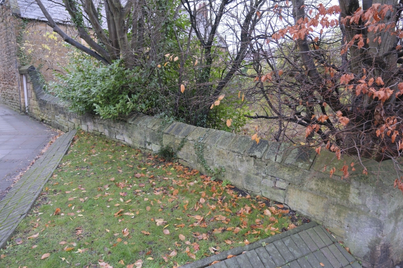
Garden walls, probably C18. Roughly-squared stone with cut dressings. Walls
with gabled coping enclosing rectangular garden, coping ramped up over boarded
door adjacent to south-west corner of house.
Listing NGR: NZ2666676966
External links are from the relevant listing authority and, where applicable, Wikidata. Wikidata IDs may be related buildings as well as this specific building. If you want to add or update a link, you will need to do so by editing the Wikidata entry.


Other nearby listed buildings
