Approximate Location Map
Large Map »
Latitude: 55.3034 / 55°18'12"N
Longitude: -1.7946 / 1°47'40"W
OS Eastings: 413140
OS Northings: 601051
OS Grid: NU131010
Mapcode National: GBR H7X3.8P
Mapcode Global: WHC1X.DYPQ
Plus Code: 9C7W8634+95
Entry Name: Pant on North of Junction with Church Street
Listing Date: 15 September 1988
Grade: II
Source: Historic England
Source ID: 1041853
English Heritage Legacy ID: 236823
ID on this website: 101041853
Location: Longframlington, Northumberland, NE65
County: Northumberland
Civil Parish: Longframlington
Built-Up Area: Longframlington
Traditional County: Northumberland
Lieutenancy Area (Ceremonial County): Northumberland
Church of England Parish: Longframlington with Brinkburn
Church of England Diocese: Newcastle
Tagged with: Building
LONGFRAMLINGTON FRONT STREET
NU 10 SW
(West side)
Longframlington
Village
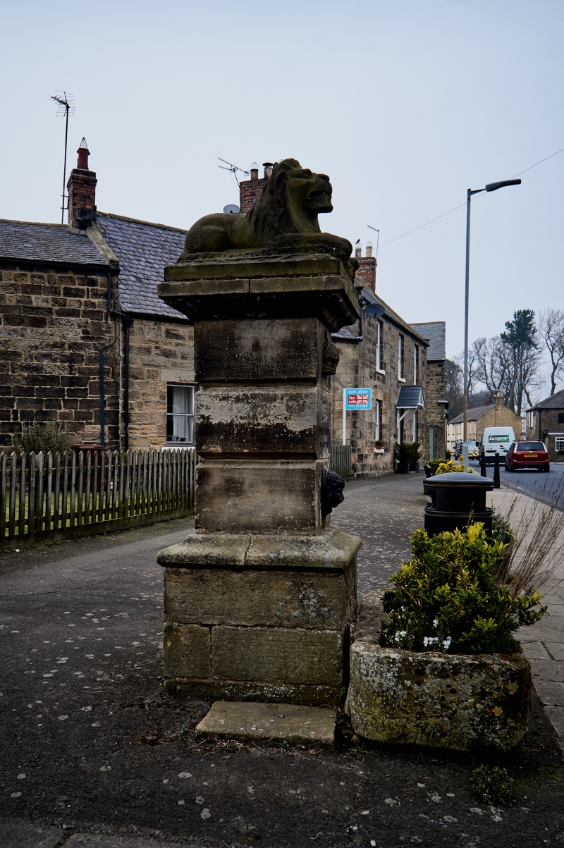
5/154 Pant on north
of junction with
Church Street
GV II
Pant, 1911, to commemorate Coronation. Cut stone. Rusticated square shaft
on moulded plinth carrying moulded cap with lion couchant; above tap (removed)
on shaft is inscription 'GEORGE V AND QUEEN MARY JUNE 22ND 1911'. Monolithic
stone trough with rounded ends, now capped over.
Listing NGR: NU1314101051
External links are from the relevant listing authority and, where applicable, Wikidata. Wikidata IDs may be related buildings as well as this specific building. If you want to add or update a link, you will need to do so by editing the Wikidata entry.


Other nearby listed buildings
