Latitude: 55.472 / 55°28'19"N
Longitude: -1.8422 / 1°50'32"W
OS Eastings: 410070
OS Northings: 619813
OS Grid: NU100198
Mapcode National: GBR H5K5.Y7
Mapcode Global: WHC13.NQYF
Plus Code: 9C7WF5C5+R4
Entry Name: Farmbuilding Group to North of Cockhall Cottages
Listing Date: 25 August 1987
Grade: II
Source: Historic England
Source ID: 1042006
English Heritage Legacy ID: 236493
ID on this website: 101042006
Location: Eglingham, Northumberland, NE66
County: Northumberland
Civil Parish: Eglingham
Traditional County: Northumberland
Lieutenancy Area (Ceremonial County): Northumberland
Church of England Parish: Eglingham St Maurice
Church of England Diocese: Newcastle
Tagged with: Agricultural structure
EGLINGHAM B 6346 NU 1019 (North side) 19/152 Farmbuilding group to north of Cockhall Cottages GV II
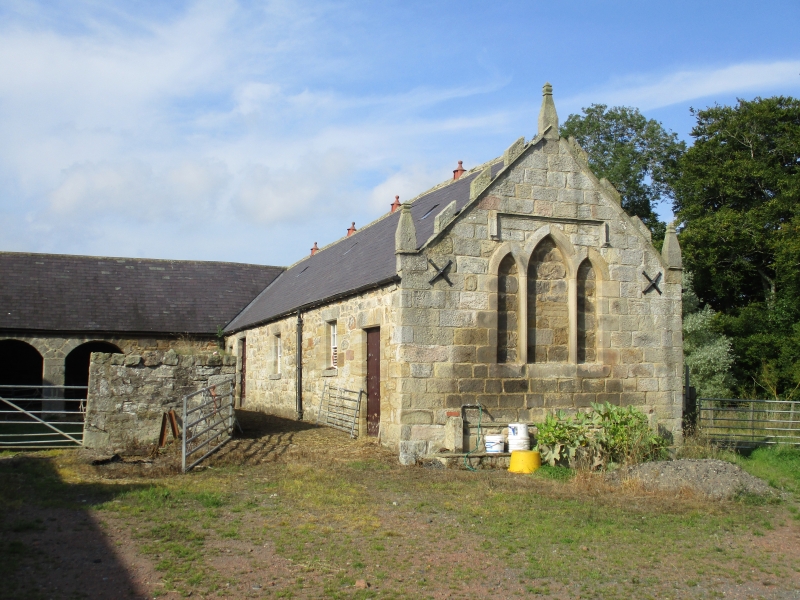
Farmbuildings around foldyard; north and east ranges mid-C18, south end of east range c.1800, west range mid C19. C18 parts large roughly-squared stone, C19 parts roughly-squared stone with tooled-and-margined dressings. Welsh slate roofs except for blue asbestos slates on east range. Single-storey ranges around yard open to south. North range shows arcade of 3 segmental arches. East range has 2 boarded doors and 2 part-slatted windows; right return is Gothick eyecatcher with stepped triplet of blind lancets under Tudor hoodmould, and embattled gable with finials. Taller west range has part-slatted windows and hipped roof.
Rear elevation of west range shows segment-headed arch with traces of former gingang to right and pent cartshed on left. Large raking buttress to rear of east range.
Listing NGR: NU1007019813
External links are from the relevant listing authority and, where applicable, Wikidata. Wikidata IDs may be related buildings as well as this specific building. If you want to add or update a link, you will need to do so by editing the Wikidata entry.


Other nearby listed buildings