Latitude: 55.6701 / 55°40'12"N
Longitude: -1.8013 / 1°48'4"W
OS Eastings: 412594
OS Northings: 641860
OS Grid: NU125418
Mapcode National: GBR H2VW.T8
Mapcode Global: WHC05.9RG3
Plus Code: 9C7WM5CX+2F
Entry Name: Village Cross, Sundial and Railings
Listing Date: 15 May 1986
Grade: II
Source: Historic England
Source ID: 1042309
English Heritage Legacy ID: 237736
ID on this website: 101042309
Location: Holy Island, Northumberland, TD15
County: Northumberland
Civil Parish: Holy Island
Traditional County: Northumberland
Lieutenancy Area (Ceremonial County): Northumberland
Church of England Parish: Holy Island St Mary the Virgin
Church of England Diocese: Newcastle
Tagged with: High cross
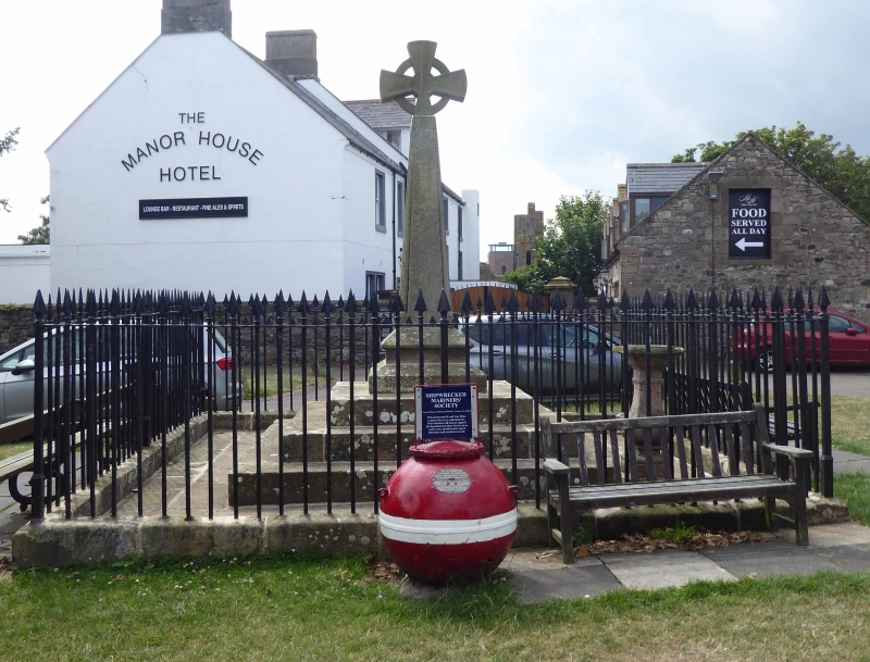
NU 1241 HOLY ISLAND MARKET PLACE
12/27 Village cross, sundial
and railings
GV II
Village cross, sundial and railings. Rebuilt by H.C. Selby esq. 1828. Sandstone
with wrought-iron railings.
Cross has plinth of 4 square steps; wheel-head cross on tapering square shaft
c.10 ft high with roll-moulded edges.
C18 sundial with baluster stem and bronze gnomon set on north-west corner of base.
Surrounded by low stone wall and railings with spearhead standards.
Listing NGR: NU1259441860
External links are from the relevant listing authority and, where applicable, Wikidata. Wikidata IDs may be related buildings as well as this specific building. If you want to add or update a link, you will need to do so by editing the Wikidata entry.


Other nearby listed buildings