Approximate Location Map
Large Map »
Latitude: 54.9781 / 54°58'41"N
Longitude: -1.8249 / 1°49'29"W
OS Eastings: 411302
OS Northings: 564851
OS Grid: NZ113648
Mapcode National: GBR HBPW.P8
Mapcode Global: WHC3M.Y44J
Plus Code: 9C6WX5HG+72
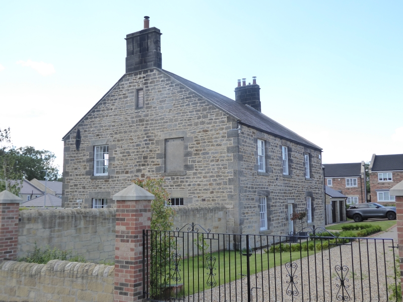
Entry Name: Wylam Hills Farmhouse
Listing Date: 7 March 1985
Grade: II
Source: Historic England
Source ID: 1044960
English Heritage Legacy ID: 239518
ID on this website: 101044960
Location: Wylam, Northumberland, NE41
County: Northumberland
Civil Parish: Wylam
Built-Up Area: Wylam
Traditional County: Northumberland
Lieutenancy Area (Ceremonial County): Northumberland
Church of England Parish: Wylam St Oswin
Church of England Diocese: Newcastle
Tagged with: Farmhouse
NZ 16 SW WYLAM CHURCH ROAD
19/144 Wylam Hills Farmhouse
II
Farmhouse. Early-mid C19. Late C20 lean-to addition on left. Dressed stone
on plinth with Lakeland slate roof. 2-bay left wing and later lean-to of
random rubble with Welsh slate roof. 2 storeys. 3 plus 2 bays. Main block
has central flush-panelled door deep-set in plain surround. 16-pane sashes
on front, right return and rear. 2-bay left extension, with lean-to in front,
has C20 12-pane sashes. Gabled roof with flat coping and 2 stone corniced end
stacks.
Listing NGR: NZ1130264851
External links are from the relevant listing authority and, where applicable, Wikidata. Wikidata IDs may be related buildings as well as this specific building. If you want to add or update a link, you will need to do so by editing the Wikidata entry.


Other nearby listed buildings
