Latitude: 54.9769 / 54°58'36"N
Longitude: -1.8244 / 1°49'27"W
OS Eastings: 411335
OS Northings: 564716
OS Grid: NZ113647
Mapcode National: GBR HBPW.TQ
Mapcode Global: WHC3M.Y5DG
Plus Code: 9C6WX5GG+Q6
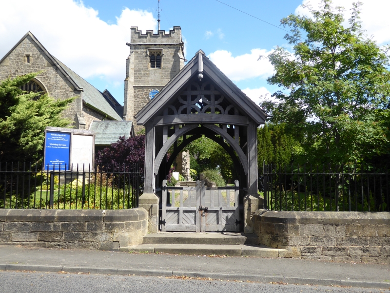
Entry Name: Lychgate C20 Yards South-West of Church of St Oswin
Listing Date: 7 March 1985
Grade: II
Source: Historic England
Source ID: 1154905
English Heritage Legacy ID: 239517
ID on this website: 101154905
Location: St Oswin's Church, Wylam, Northumberland, NE41
County: Northumberland
Civil Parish: Wylam
Built-Up Area: Wylam
Traditional County: Northumberland
Lieutenancy Area (Ceremonial County): Northumberland
Church of England Parish: Wylam St Oswin
Church of England Diocese: Newcastle
Tagged with: Lychgate
NZ 16 SW
19/143
WYLAM
CHURCH ROAD
Lychgate c20 yards south-west of Church of St. Oswin
GV
II
Lychgate. 1903. Oak on ashlar base. Lakeland slate roof. Moulded arched
braces support coved tie beam. Close studding in spandrels. Gable is filled
with ornamental panelling.
Listing NGR: NZ1133564716
External links are from the relevant listing authority and, where applicable, Wikidata. Wikidata IDs may be related buildings as well as this specific building. If you want to add or update a link, you will need to do so by editing the Wikidata entry.


Other nearby listed buildings