Latitude: 53.2588 / 53°15'31"N
Longitude: -1.0699 / 1°4'11"W
OS Eastings: 462144
OS Northings: 373938
OS Grid: SK621739
Mapcode National: GBR NZZR.5J
Mapcode Global: WHFGL.JCR2
Plus Code: 9C5W7W5J+G2
Entry Name: The Grotto
Listing Date: 30 September 1977
Grade: II*
Source: Historic England
Source ID: 1045034
English Heritage Legacy ID: 241268
ID on this website: 101045034
Location: Bassetlaw, Nottinghamshire, S80
County: Nottinghamshire
District: Bassetlaw
Civil Parish: Clumber and Hardwick
Traditional County: Nottinghamshire
Lieutenancy Area (Ceremonial County): Nottinghamshire
Church of England Parish: Worksop Priory with Carburton
Church of England Diocese: Southwell and Nottingham
Tagged with: Grotto
SK 67 SW WORKSOP CLUMBER PARK
5/60 The Grotto
30.9.77
G.V. II*
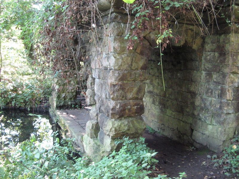
Grotto. c.1765. By Stephen Wright for the Duke of Newcastle.
Rockfaced ashlar. Slab roof. Single storey, single bay. Plinth
and cornice with heavy echinus moulding. Front has semi-circular
arch with projecting keystones. Similar smaller arches in return
angles. Central doorway. Contains late C19 water turbine
driving 3 throw water pump.
Listing NGR: SK6214473938
External links are from the relevant listing authority and, where applicable, Wikidata. Wikidata IDs may be related buildings as well as this specific building. If you want to add or update a link, you will need to do so by editing the Wikidata entry.


Other nearby listed buildings