Latitude: 53.309 / 53°18'32"N
Longitude: -0.9431 / 0°56'35"W
OS Eastings: 470520
OS Northings: 379635
OS Grid: SK705796
Mapcode National: GBR PZV5.MJ
Mapcode Global: WHFGG.H343
Plus Code: 9C5X8354+HQ
Entry Name: 5, High Street
Listing Date: 5 November 1976
Grade: II
Source: Historic England
Source ID: 1045180
English Heritage Legacy ID: 240923
ID on this website: 101045180
Location: Bassetlaw, Nottinghamshire, DN22
County: Nottinghamshire
District: Bassetlaw
Town: Bassetlaw
Electoral Ward/Division: East Retford South
Built-Up Area: Retford
Traditional County: Nottinghamshire
Lieutenancy Area (Ceremonial County): Nottinghamshire
Church of England Parish: Ordsall
Church of England Diocese: Southwell and Nottingham
Tagged with: Building
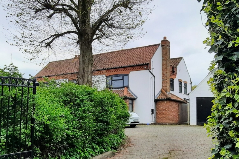
HIGH STREET
1.
5345
(North West Side)
Ordsall
No 5
SK 7179 12/121
II
2.
Early C19. 2 storeys, rendered on brick, with pantile roof and centre stacks.
2 segmental-headed windows with glazing bars to sliding sashes on both floors,
wood shutters. Gabled porch and plain door. Penticed 1-storey extension to
right with modern window.
Listing NGR: SK7052079635
This text is from the original listing, and may not necessarily reflect the current setting of the building.
External links are from the relevant listing authority and, where applicable, Wikidata. Wikidata IDs may be related buildings as well as this specific building. If you want to add or update a link, you will need to do so by editing the Wikidata entry.


Other nearby listed buildings