Latitude: 53.2235 / 53°13'24"N
Longitude: -1.0758 / 1°4'32"W
OS Eastings: 461803
OS Northings: 370003
OS Grid: SK618700
Mapcode National: GBR 9FP.YN4
Mapcode Global: WHFGS.F7ZN
Plus Code: 9C5W6WFF+9M
Entry Name: Former Village Room
Listing Date: 11 August 1961
Last Amended: 20 June 1986
Grade: II
Source: Historic England
Source ID: 1045479
English Heritage Legacy ID: 242247
ID on this website: 101045479
Location: Budby, Newark and Sherwood, Nottinghamshire, NG22
County: Nottinghamshire
District: Newark and Sherwood
Town: Newark and Sherwood
Civil Parish: Perlethorpe cum Budby
Traditional County: Nottinghamshire
Lieutenancy Area (Ceremonial County): Nottinghamshire
Church of England Parish: Edwinstowe
Church of England Diocese: Southwell and Nottingham
Tagged with: Building
PERLETHORPE MAIN STREET SK 67 SW and SK 66 NW CUM BUDBY (formerly Carburton Road) (west side) 1/105 and 3/105 Former Village Room 11.8.61 G.V. II
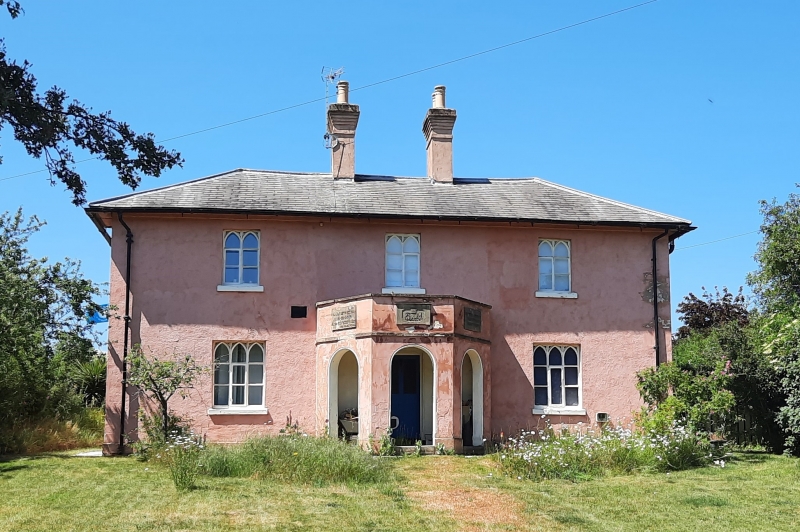
Village school, later Village Room, now house. 1807. By William Wilkins Jnr. Brick, rendered, with hipped slate roof. Stone plinth and dressings. 2 ridge stacks. 2 storeys, 3 bays, single range with lean-to at rear. Windows are mainly Gothick casements. East front has central canted portico with band and coped parapet. 3 round headed openings. Parapet has central plaque inscribed 'A M MDCCCVII'. to left, plaque inscribed 'Hear instruction and be wise and refuse it not. Provb. Ch. VII. v.33'. To right, plaque, inscribed 'Be pious, patient, honest and industrious'. Beyond, single casements. Above, 3 smaller casements. ,Rear has central single storey outbuilding, brick with slate roof. To north, central door and above, flat roofed dormer with glazing bar sash. Rear elevation has to left, C20 conservatory and to right, 2 casements. Above, to left, hipped cross eaves dormer. South end has 2 casements and above, central hipped cross eaves dormer. North end has 2 casements on each floor. This building is part of the complete Estate Village laid out by Earl Manvers of Thoresby Park 1807-1812.
Listing NGR: SK6180370003
External links are from the relevant listing authority and, where applicable, Wikidata. Wikidata IDs may be related buildings as well as this specific building. If you want to add or update a link, you will need to do so by editing the Wikidata entry.


Other nearby listed buildings