Approximate Location Map
Large Map »
Latitude: 53.0344 / 53°2'3"N
Longitude: -0.9644 / 0°57'51"W
OS Eastings: 469542
OS Northings: 349068
OS Grid: SK695490
Mapcode National: GBR BKH.P11
Mapcode Global: WHFHM.5Z0N
Plus Code: 9C5X22MP+Q6
Entry Name: Cart Shed at Manor Farm
Listing Date: 13 March 1986
Grade: II
Source: Historic England
Source ID: 1045567
English Heritage Legacy ID: 242048
ID on this website: 101045567
Location: Thurgarton, Newark and Sherwood, Nottinghamshire, NG14
County: Nottinghamshire
District: Newark and Sherwood
Civil Parish: Thurgarton
Built-Up Area: Thurgarton
Traditional County: Nottinghamshire
Lieutenancy Area (Ceremonial County): Nottinghamshire
Church of England Parish: Thurgarton
Church of England Diocese: Southwell and Nottingham
Tagged with: Carriage house
SK 64 NE
4/96
THURGARTON
BECK STREET
(north side)
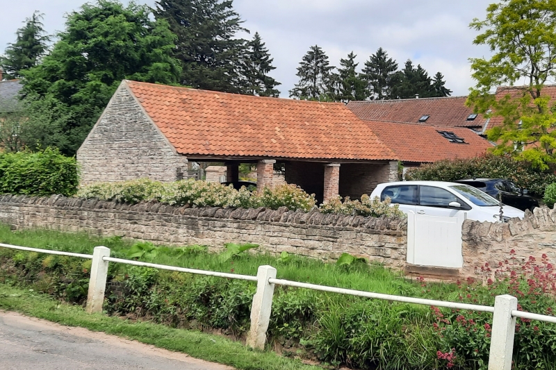
Cart Shed at Manor Farm
G.V.
II
Cartshed. Early C19. Dressed coursed rubble and red brick.
Pantile roof. Single storey, 3 bays. Open on 2 sides. 2 red
brick posts with rubble caps. Gable walls of dressed coursed
rubble.
Listing NGR: SK6954249068
External links are from the relevant listing authority and, where applicable, Wikidata. Wikidata IDs may be related buildings as well as this specific building. If you want to add or update a link, you will need to do so by editing the Wikidata entry.


Other nearby listed buildings
