Approximate Location Map
Large Map »
Latitude: 53.1891 / 53°11'20"N
Longitude: -0.9993 / 0°59'57"W
OS Eastings: 466959
OS Northings: 366250
OS Grid: SK669662
Mapcode National: GBR 9GD.05V
Mapcode Global: WHFH0.M3BG
Plus Code: 9C5X52Q2+M7
Entry Name: Boundary Wall at Wellow Hall
Listing Date: 28 April 1986
Grade: II
Source: Historic England
Source ID: 1045612
English Heritage Legacy ID: 241946
ID on this website: 101045612
Location: Wellow, Newark and Sherwood, Nottinghamshire, NG22
County: Nottinghamshire
District: Newark and Sherwood
Civil Parish: Wellow
Built-Up Area: Wellow
Traditional County: Nottinghamshire
Lieutenancy Area (Ceremonial County): Nottinghamshire
Church of England Parish: Wellow
Church of England Diocese: Southwell and Nottingham
Tagged with: Wall
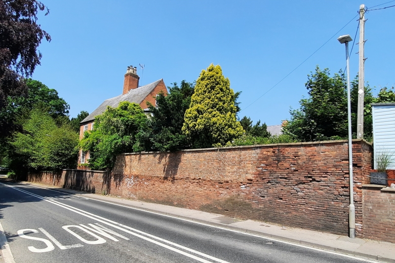
WELLOW NEWARK ROAD
SK 66 NE
(north side)
3/96 Boundary wall at
Wellow Hall
G.V. II
Boundary wall. C18 and C19. Brick with ramped ashlar and brick
copings. L-plan. Rounded corner at east end. Approx. 170 M
long.
Listing NGR: SK6695966250
External links are from the relevant listing authority and, where applicable, Wikidata. Wikidata IDs may be related buildings as well as this specific building. If you want to add or update a link, you will need to do so by editing the Wikidata entry.


Other nearby listed buildings
