Latitude: 53.2117 / 53°12'42"N
Longitude: -0.9053 / 0°54'19"W
OS Eastings: 473203
OS Northings: 368855
OS Grid: SK732688
Mapcode National: GBR BHF.RXX
Mapcode Global: WHFGW.2J5P
Plus Code: 9C5X636V+MV
Entry Name: Barn South East of Stone House
Listing Date: 28 April 1986
Grade: II
Source: Historic England
Source ID: 1045625
English Heritage Legacy ID: 241872
ID on this website: 101045625
Location: Egmanton, Newark and Sherwood, Nottinghamshire, NG22
County: Nottinghamshire
District: Newark and Sherwood
Civil Parish: Egmanton
Built-Up Area: Egmanton
Traditional County: Nottinghamshire
Lieutenancy Area (Ceremonial County): Nottinghamshire
Church of England Parish: Egmanton
Church of England Diocese: Southwell and Nottingham
Tagged with: Barn
EGMANTON KIRTON ROAD SK 76 NW (south side) 4/22 Barn south east of Stone House
G.V. II
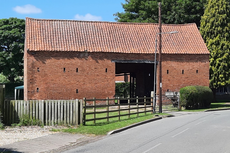
Threshing barn. C18. Brick with pantile roof. Dentillated eaves, single storey, 3 unequal bays. L-plan. East front has off-centre doorway with timber lintel, flanked by 2 slit breathers to left, and 3 similar breathers to right. Above, 7 breathers. West side has corresponding lower door with timber lintel and a pair of plank doors. To right, 2 breathers and above, 4 breathers. North and south gables have each 4 tiers of breathers and single cross breathers in peaks. Principal rafter roof with tenoned purlins, collars and rafters. West side has adjoining range of C19 and C20 brick and timber outbuildings with pantile and Roman tile roofs, not of special interest.
Listing NGR: SK7320368855
External links are from the relevant listing authority and, where applicable, Wikidata. Wikidata IDs may be related buildings as well as this specific building. If you want to add or update a link, you will need to do so by editing the Wikidata entry.


Other nearby listed buildings