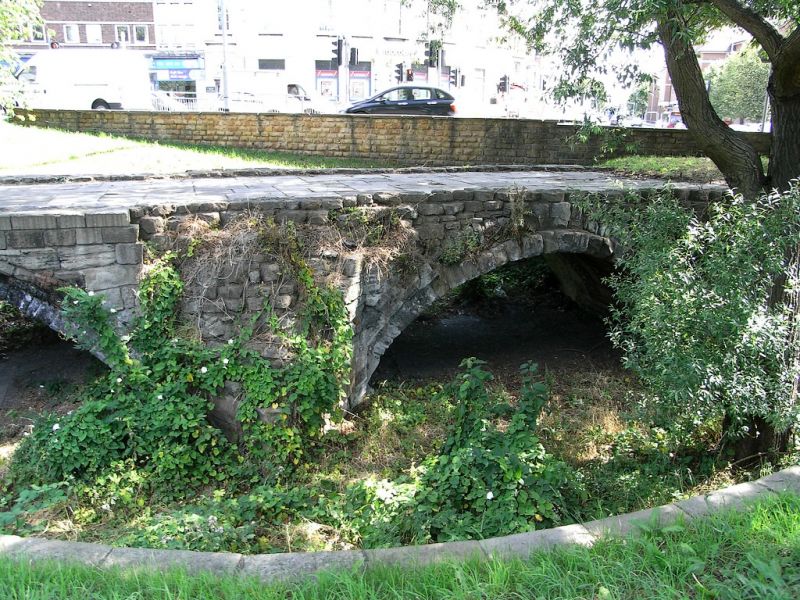
Latitude: 52.9374 / 52°56'14"N
Longitude: -1.1351 / 1°8'6"W
OS Eastings: 458228
OS Northings: 338128
OS Grid: SK582381
Mapcode National: GBR LSW.D5
Mapcode Global: WHDGZ.JFQG
Plus Code: 9C4WWVP7+XX
Entry Name: Old Trent Bridge Flood Arches
Listing Date: 13 April 1987
Grade: II
Source: Historic England
Source ID: 1045637
English Heritage Legacy ID: 241796
ID on this website: 101045637
Location: West Bridgford, Rushcliffe, Nottinghamshire, NG2
County: Nottinghamshire
District: Rushcliffe
Electoral Ward/Division: Trent Bridge
Parish: Non Civil Parish
Built-Up Area: West Bridgford
Traditional County: Nottinghamshire
Lieutenancy Area (Ceremonial County): Nottinghamshire
Church of England Parish: West Bridgford
Church of England Diocese: Southwell and Nottingham
SK 53 NE WEST BRIDGFORD LONDON ROAD
1/5 Old Trent Bridge Flood Arches
II
Flood arches. C13, C14, C15. Restored C19 and C20. Dressed stone and brick. To west, 2 segmental arches, that to left double chamfered and with remains of hood mould. Pointed central cutwater. East side has 2 chamfered semi-circular arches with chamfered hood moulds. Also a Scheduled Ancient Monument, County List No.30.
Listing NGR: SK5822838128


Other nearby listed buildings