Latitude: 51.2983 / 51°17'53"N
Longitude: 1.1225 / 1°7'20"E
OS Eastings: 617773
OS Northings: 160091
OS Grid: TR177600
Mapcode National: GBR TXY.GMJ
Mapcode Global: VHLGG.DMRL
Plus Code: 9F3374XC+8X
Entry Name: Meadow Cottages
Listing Date: 28 June 1976
Grade: II
Source: Historic England
Source ID: 1045923
English Heritage Legacy ID: 171456
ID on this website: 101045923
Location: Sturry, Canterbury, Kent, CT2
County: Kent
District: Canterbury
Civil Parish: Sturry
Built-Up Area: Sturry
Traditional County: Kent
Lieutenancy Area (Ceremonial County): Kent
Tagged with: Cottage
1. 5274 STURRY MILL ROAD Nos 1 and 2
(Meadow Cottages) TR 1760 32/592 28.6.76
II GV
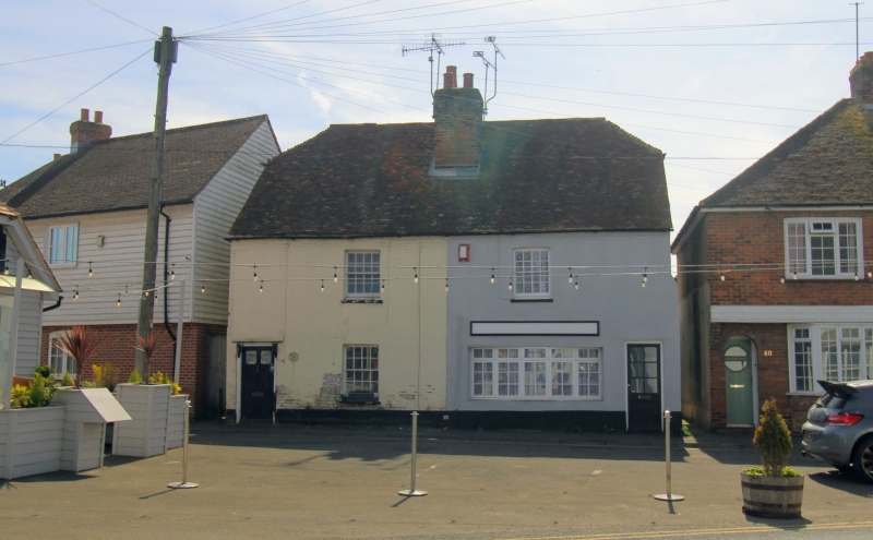
2. C18 pair. Two storeys colourwashed brick. Half-hipped tiled roof with brick modillion cornice. One sash to each with glazing bars intact. No 2 has an inserted modern bow shop front to the ground floor and simple doorcase. No 1 has shutters to ground floor sash and a doorcase with flat hood on brackets and a 6 flush-panelled door, the top 2 panels cut away and glazed.
Listing NGR: TR1747959974
External links are from the relevant listing authority and, where applicable, Wikidata. Wikidata IDs may be related buildings as well as this specific building. If you want to add or update a link, you will need to do so by editing the Wikidata entry.


Other nearby listed buildings