Latitude: 51.2983 / 51°17'54"N
Longitude: 1.121 / 1°7'15"E
OS Eastings: 617672
OS Northings: 160094
OS Grid: TR176600
Mapcode National: GBR TXY.G8J
Mapcode Global: VHLGG.DM0K
Plus Code: 9F3374XC+8C
Entry Name: 5 and 6, Chapel Lane
Listing Date: 14 March 1980
Grade: II
Source: Historic England
Source ID: 1298862
English Heritage Legacy ID: 171424
ID on this website: 101298862
Location: Sturry, Canterbury, Kent, CT2
County: Kent
District: Canterbury
Civil Parish: Sturry
Built-Up Area: Sturry
Traditional County: Kent
Lieutenancy Area (Ceremonial County): Kent
Tagged with: Building
1. 5273 STURRY CHAPEL LANE
Nos 5 and 6 TR 1760 32/566
II
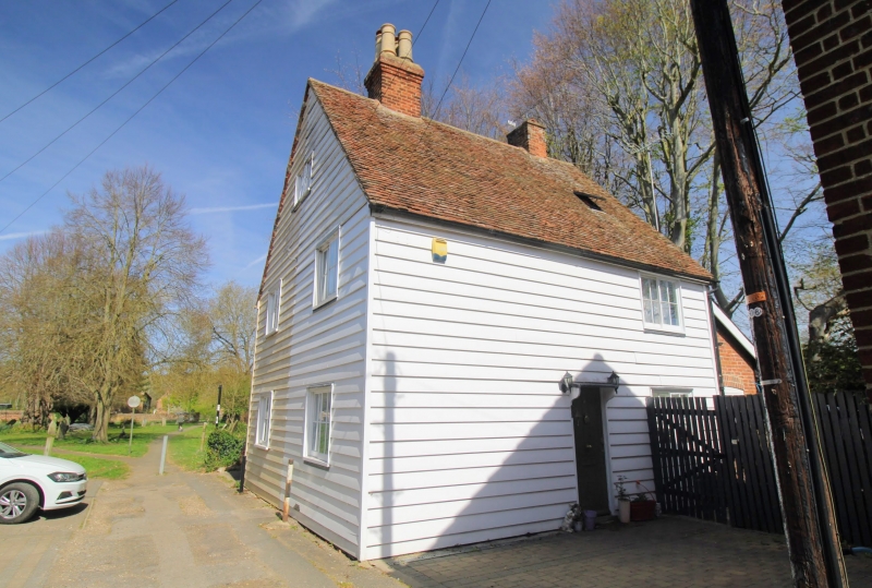
2. Early C19 back to back pair. Two storeys weatherboarded. Tiled roof having attic storey with gable end. One sliding casement each to front elevations. Side elevations have 2 casements. Simple wooden doorcase with flat hood on brackets on north and south elevations.
Listing NGR: TR1767460096
External links are from the relevant listing authority and, where applicable, Wikidata. Wikidata IDs may be related buildings as well as this specific building. If you want to add or update a link, you will need to do so by editing the Wikidata entry.


Other nearby listed buildings